
Walking the southern half of Offa’s Dyke Trail along the English-Welsh border
Having walked a number of undulating National Trails in recent years – including the South Downs Way and Hadrian’s Wall Path – I looked for something a little more challenging and remote to tackle in 2022. The obvious choice seemed to be the Offa’s Dyke Trail – though the walking was a bit tougher at times than I’d anticipated.
The trail is 177 miles long, linking Sedbury Cliffs – near Chepstow – on the banks of the Severn estuary with the coastal town of Prestatyn on the shores of the Irish sea. It is named after, and often follows, the spectacular dyke that King Offa ordered to be constructed in the 8th century, probably to divide his Kingdom of Mercia from rival kingdoms in what is now Wales
My plan was to complete the southern half in 2022, walking from Sedbury to Knighton, leaving the remainder for 2023. I planned the walk back in January, to ensure accommodation as close to the trail as possible; experience has taught me that trekking miles off a defined trail for an overnight stop is very demoralising. And as I only ever carry a day-pack, I relied on Walklite to move my luggage daily between hotels and B&Bs (which they did perfectly).
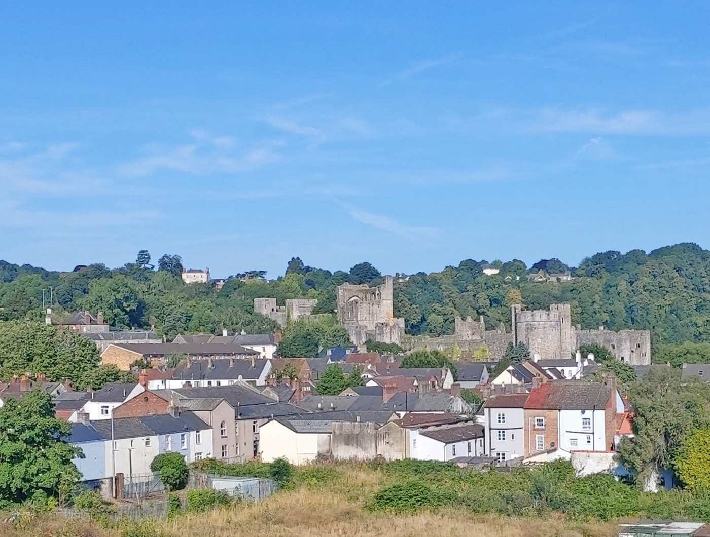
So I set off in mid-August – unfortunately in a heat wave – to start my adventure. After four trains and a reprimand for carrying an out-of-date railcard, I finally arrived at Chepstow to encounter two recurring themes of my walk: hills and castles. My hotel was a long climb up from the station in sweltering temperatures, hauling my luggage. Undaunted, after checking in I bounced back down the hill to explore Chepstow and its impressive cliff-top castle.
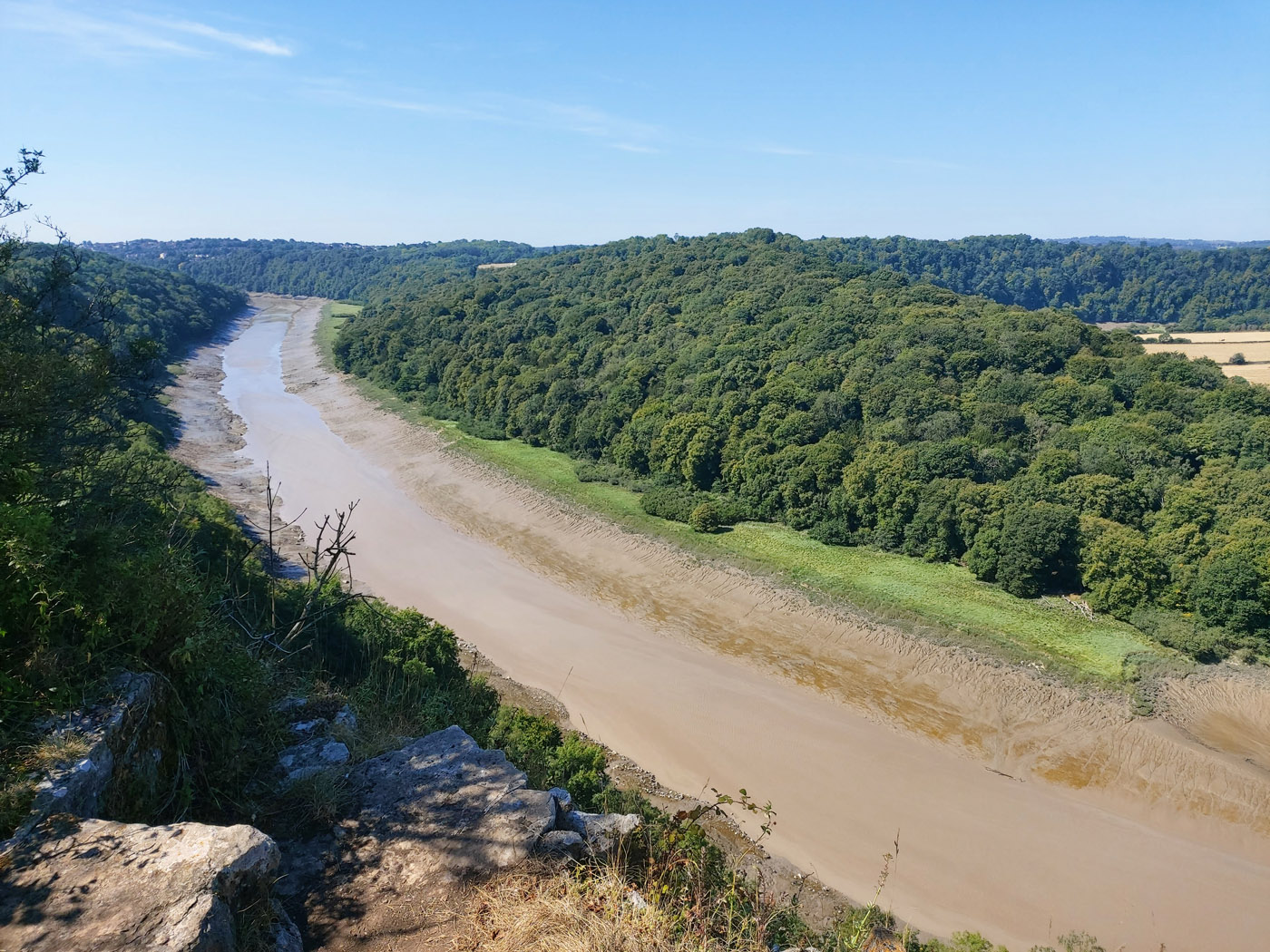
The next morning there was a 3 mile hike to the start of the trail at Sedbury cliffs, overlooking the River Severn and its suspension bridge. From here the walk proper began. After clearing the residential area, the trail followed the course of the River Wye northwards, though high above the river on steep, wooded slopes – thankfully providing shade from the increasing heat of the day.
Sadly, though this stretch of the River Wye is billed as superb scenery, the water levels were so low that only vast stretches of unsightly mud were visible. Months of low rainfall and above-average temperatures had taken their toll.
By late afternoon I crossed the River Wye – which looked a good deal healthier at this point – on a footbridge, providing access to the striking ruins of Tintern Abbey.
Bizarrely, next morning I found the footbridge closed for 9 months! This necessitated following paths along the river bank until a crossing could be made 2 miles further north and the trail regained. The river remained my focus for the rest of the day, taking me to Monmouth.


Once again, much of the trail passed through woodland high above the river – and along shady sunken lanes, thick with moss and ferns – offering relief from the burning sun that maintained temperatures of 31 degrees even at 6pm.
Not that the day’s walking was easy. Three times the trail dipped down to the river and climbed back up again. By the time I found my lodgings in Monmouth I’d done a surprising 14.7 miles and climbed a total of 2,875ft in elevation. Fortunately, at the last of these dips – down into Redbrook – there was access to the Boat Inn, via an interesting disused railway bridge across the Wye, where I could refill empty water bottles.

The next 2 days were easier by comparison, though the sun was unrelenting, there was no shade and nowhere to access even water. Leaving Monmouth and the river behind, the trail crossed endless fields, some with crops others for sheep. Rather surprisingly I passed an area of apple orchards growing fruit for cider.
After a delightful overnight at Tre-Adam it was on to Pandy and the Lancaster Arms Guest House, that couldn’t have been more cordial.
From Pandy the trail heads to Hay-on-Wye, through the Brecon Beacons National Park: a 17 mile stretch across moorland. The path climbs quite steeply onto Hatterrall Ridge and a first trig point at 1,522ft. From here the route follows along the top of Hatterrall Ridge for over 9 miles, gently climbing to 2,220ft before descending to Hay-on-Wye. So this section of the trail is not only very demanding but completely exposed, with no opportunity to break out.
Given the heat of the previous days and the Met Office weather warning of extreme heat for the following days, I made the disappointing decision that it would be unsafe to walk Hatterrall Ridge as planned. I would have to return at a later date, once the heat wave had passed.
Instead, I decided to set out from Pandy early to climb to the first trig point – just to trial this steep climb – then retrace my steps. This 6 mile round-trip could be completed safely before midday, providing a taster without over-exposing myself. On such a clear day the views were amazing – and the pathway leading north was extremely inviting.


Arriving in Hay-on-Wye by taxi later, the uncomfortable 32/33 degree heat confirmed my assessment that Hatterrall Ridge was for another day. Even my hotel room was unbearable, requiring a search for shade in the town.
The next day had been planned as a rest day but – having rested much of the previous day – I headed back to Hatterrall Ridge, this time from its northern end. Again I started early, climbed for four miles then turned back before temperatures rose too high. As expected, the skies were blue and the views clear, improving with height.
The weather finally broke the following day: temperatures dropped 10 degrees and – being Wales – light rain settled in. It was good to be able to resume my planned walking. Two arduous days lay ahead – both over 14 miles distance with over 2,000ft to climb – but it was pleasing to be clocking up miles on the trail again.
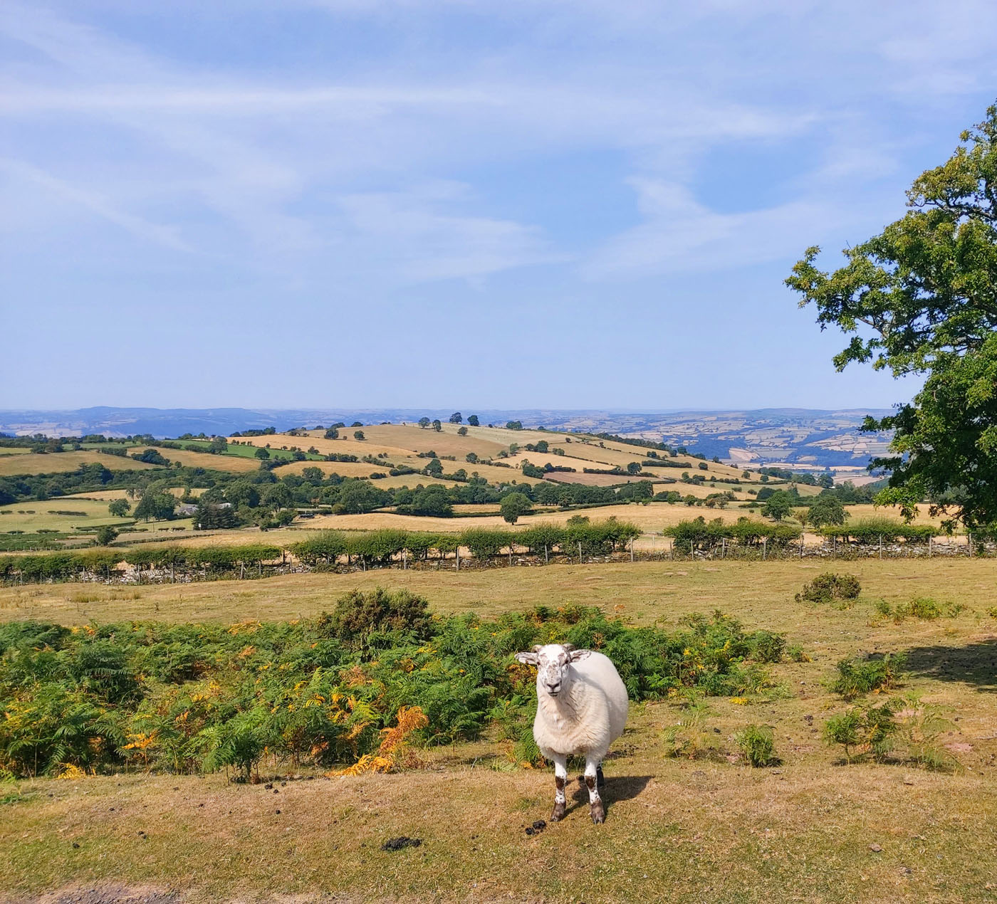
The highlight of the first of these days was traversing Hergest Ridge, made famous by Mike Oldfield: miles of peaty moorland sitting above the surrounding hills, roamed by sheep and wild Welsh ponies.


The next day at last reunited with Offa’s Dyke after an absence of over 50 miles. The dyke appears as an earthwork hump – with deep trenches on either side where it is best preserved. For much of the day the route was clearly defined by the direction of the dyke – no signposts required.
Which brought me to Knighton and the end of my initial plans. However, a week later I was back in Pandy, ready to tackle the abandoned trek along Hatterrall Ridge. The weather was kind – just a couple of light showers. The walk was stellar. The sense of remoteness, standing on top of the world, was awesome. Though, truth be told, I’ve sworn to never undertake such a demanding day ever again!
Let’s see if that holds true when I take on the northern half of Offa’s Dyke trail in 2023.


Author: Sandy Arpino