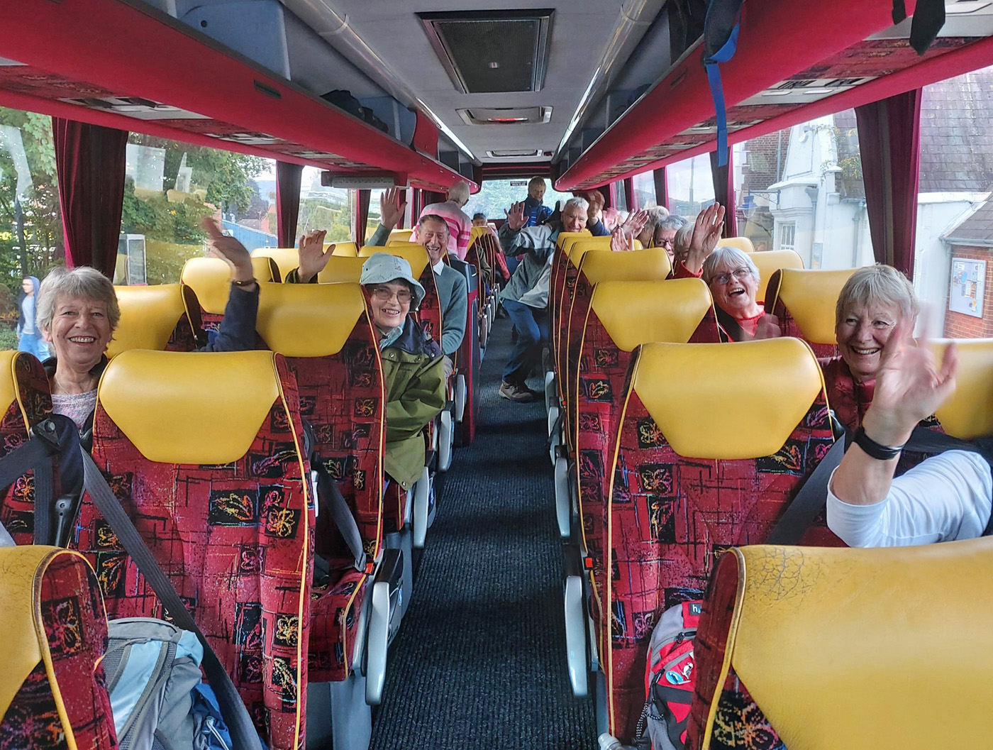
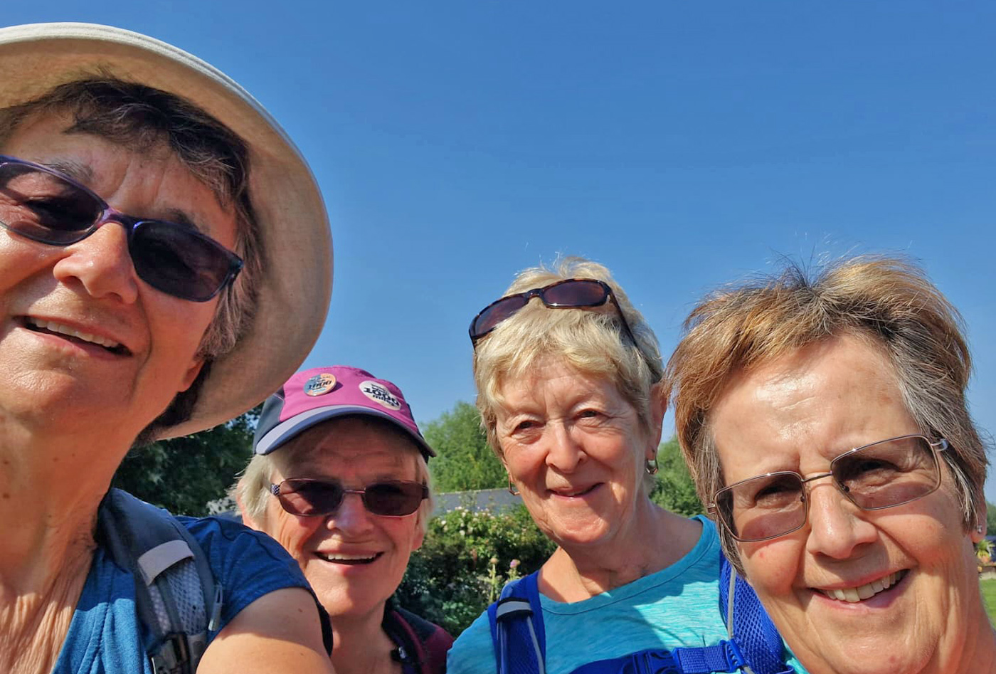
Twenty-four of us Petersfield Ramblers went to Malhamdale in the Yorkshire Dales for a 4-night break to enjoy walking the area, courtesy of HF Holidays.
We stayed in a lovely mansion, Newfield Hall, just outside the town of Malham. We were offered three walks per day of various lengths and ascents which were led by very competent leaders, Rich, Gwyneth and Greg. The food was excellent, not only B & B and dinner, but we had the most wonderful packed lunches, too. HF Holiday houses are always equipped with everything that a walker would want, notably boot storage and drying rooms – and these were very much needed!
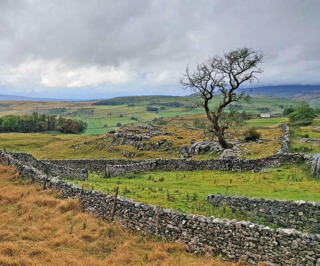
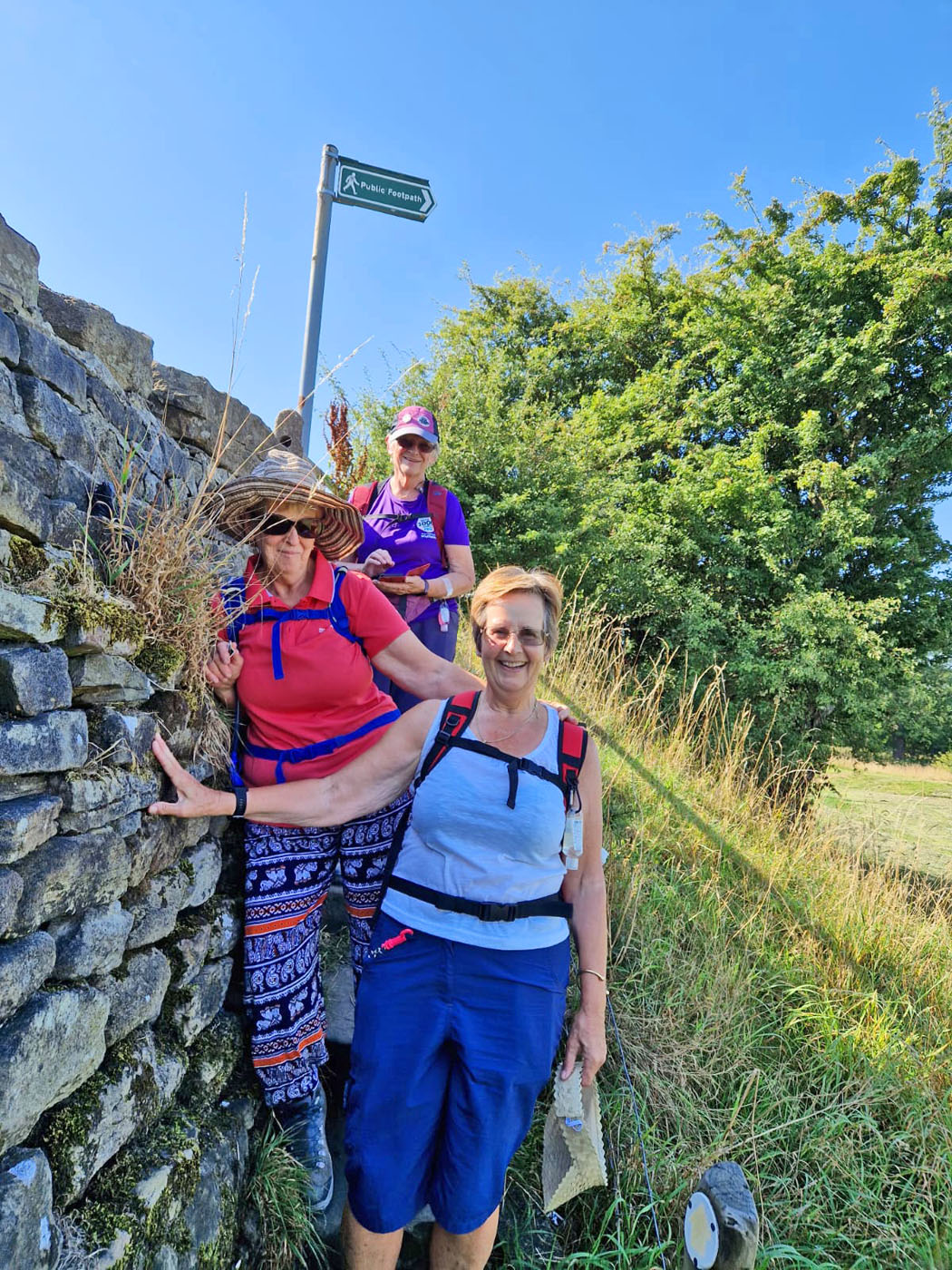
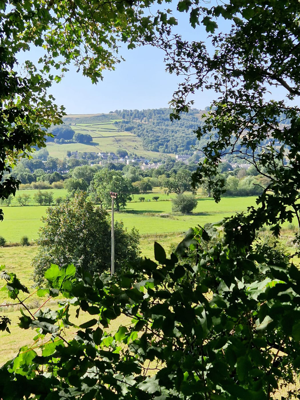
On the first walking day, Tuesday, we were led from the house and acquainted ourselves with the area of fields, woods, rivers and streams and the views. The Pennine Way runs through here so we covered a bit of that and went along the River Aire. A kingfisher was spotted, allegedly. Well, many people said they saw it, but I didn’t.
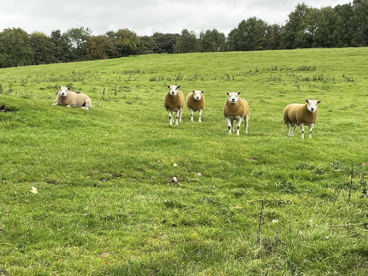
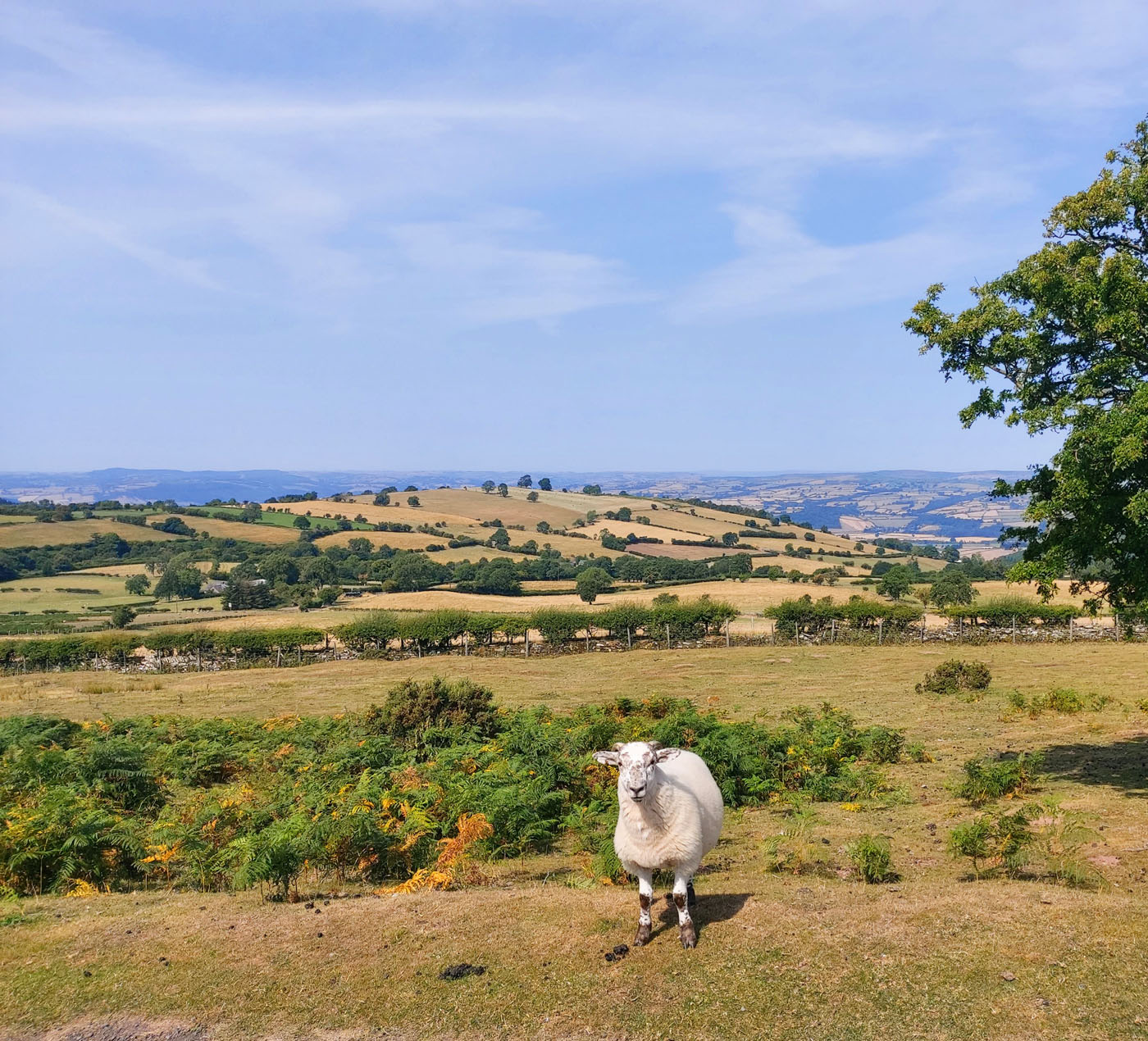
We saw hundreds of sheep – black sheep, black and white sheep, spotted sheep, sheep that looked like goats, yellow sheep, sheep that posed for us, long-haired sheep, sheep with tails, sheep without tails. I’ve never seen so many sheep! Oh, and some cattle, too.
We have our eyes on you!
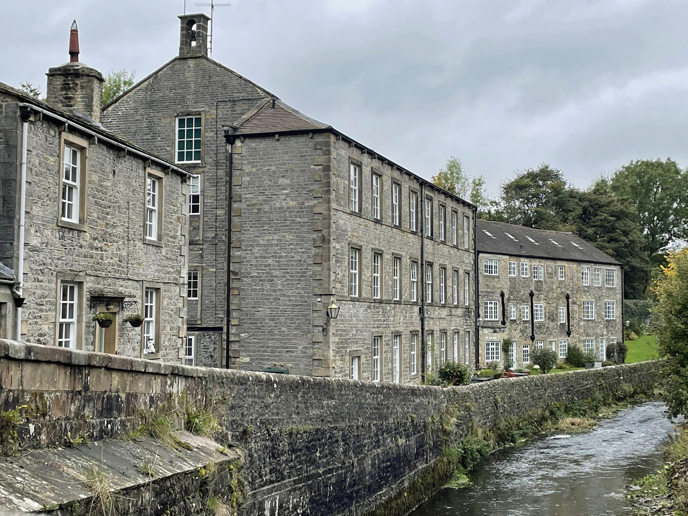
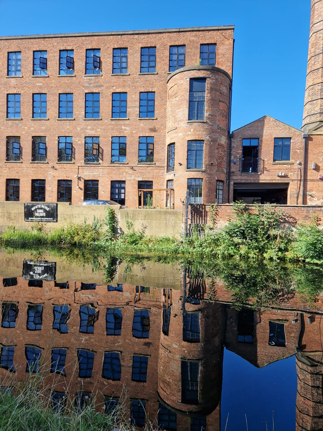
On Wednesday we were bussed to Settle into Ribbledale and went along the Dales High Way for a spell. In full wet weather clothing, we headed up the River Ribble along which we saw many mill chimneys and huge buildings; old mills now turned into living accommodation. The water was gushing over the stones and weirs in the river in full spate – I wished I could channel some of that water into Petersfield Lake!
Old Mill, now Accommodation
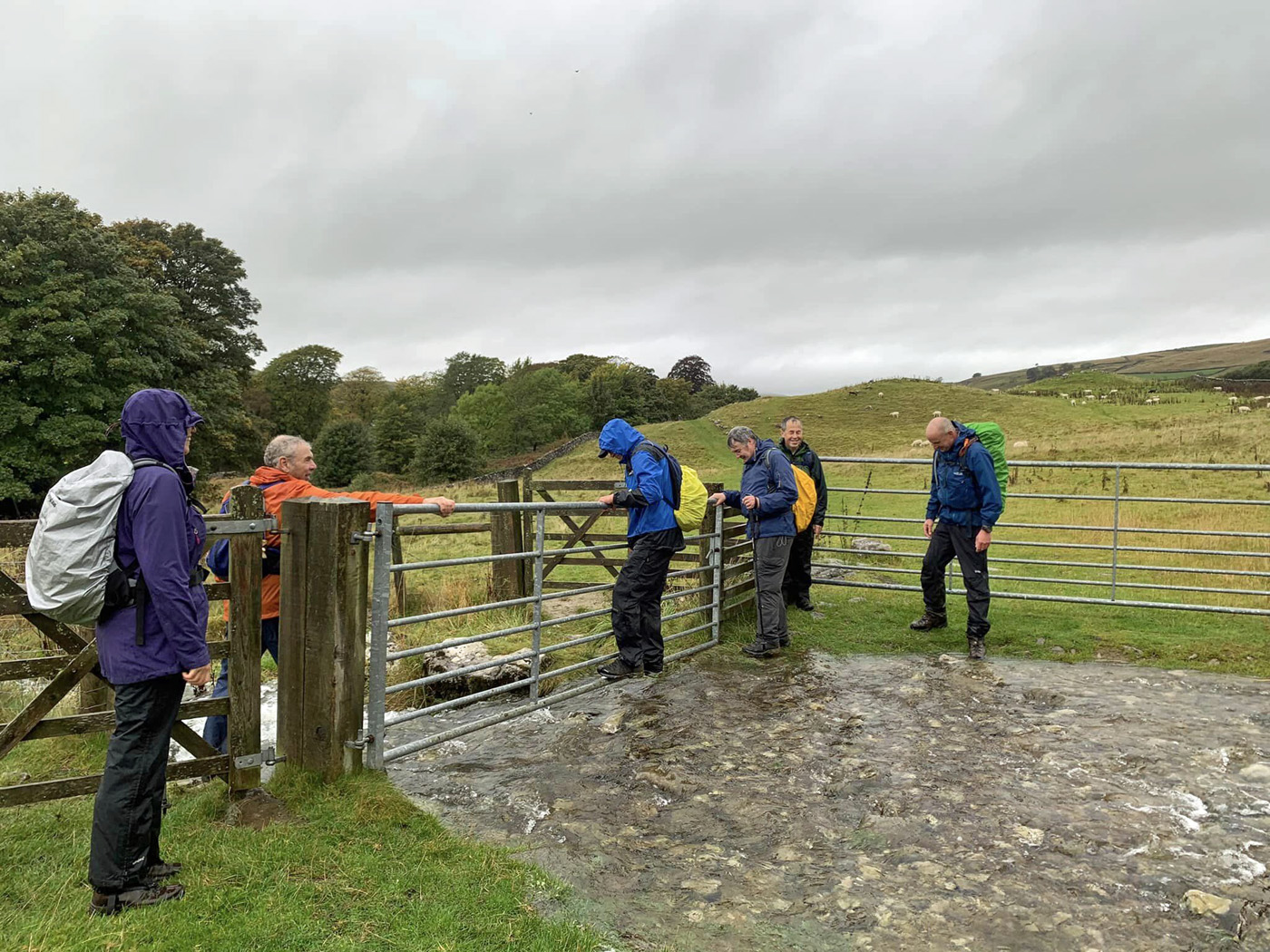
Tricky Beck Crossing
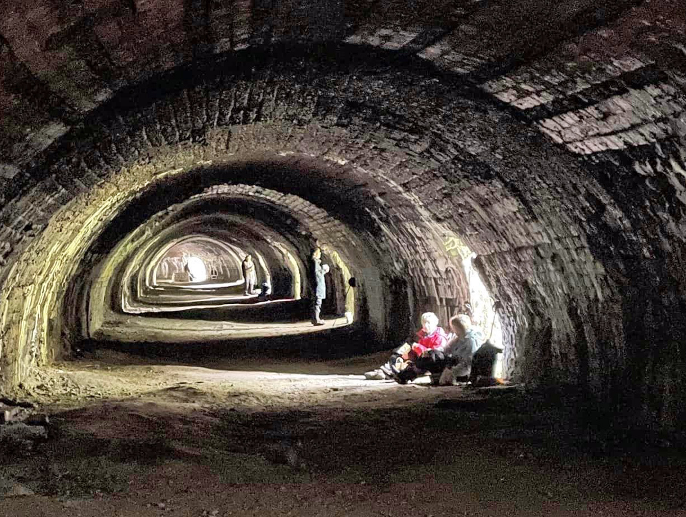
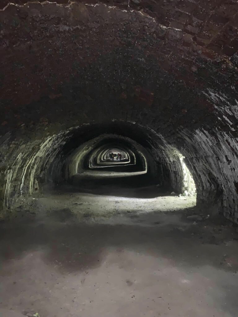
Some of the high stiles in the stone walls were very slippery because of the wet and we had to be careful. We had our lunch INSIDE a limekiln which was not the prettiest venue in which I have eaten my sandwiches, looking out at the rain! Disused since 1939 when the quarrying of limestone and lime production stopped and the workers moved out, the area is now being reclaimed by nature and peregrine falcons, jackdaws, blue tits, and willow warblers now breed on the slopes.
Lunch in Hoffmann Kiln
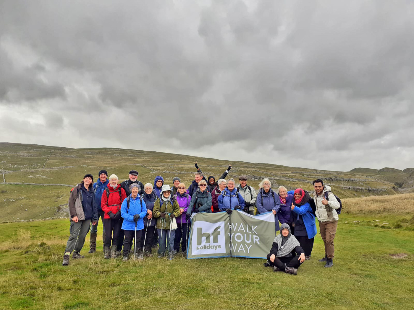
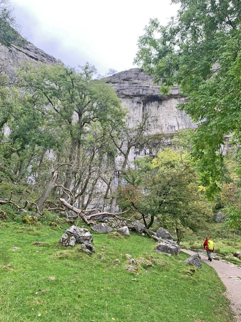
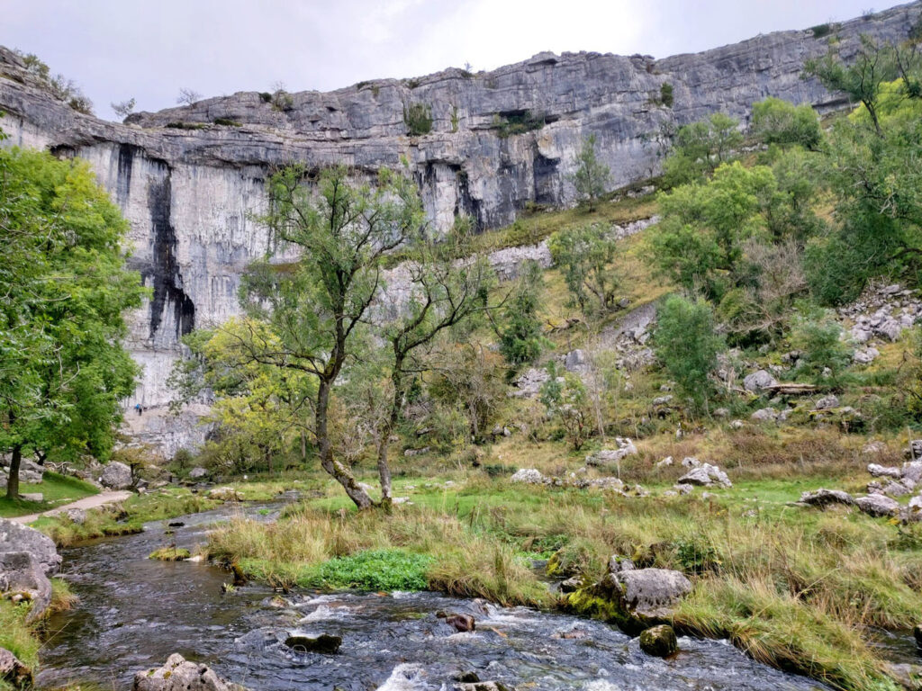
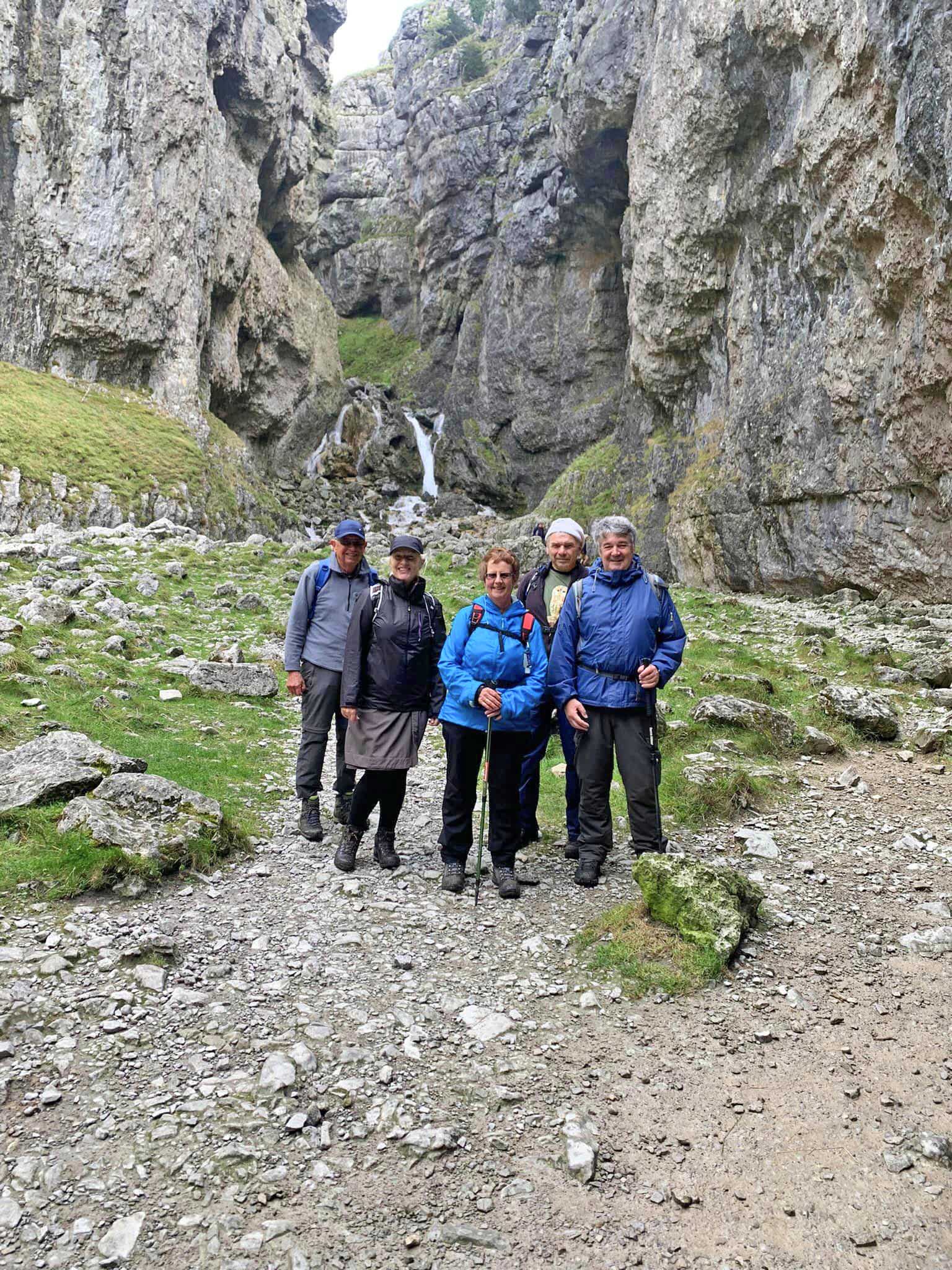
Thursday we were in the bus again and headed into Malham to enjoy the highlights of the area – Malham Tarn, Malham Cove with the limestone pavement above, Janet’s Foss (waterfall), and Gordale Scar. Here there were many more walkers enjoying the tracks and we had a great time greeting and chatting with them. One set of chatty young people joined us for our group photo and we had great fun!
Happy Walkers!
The Yorkshire Dales offers very different walking than here in Hampshire and it’s interesting to discover different terrain and challenges. Each day after walking, we peeled off our walking gear and freshened up for an evening of delicious food and socialising. What’s not to like?
Author: Sheila Gadd, Club Secretary
Photography: Sandy Arpino, Jo Legg & Lesley Stapley
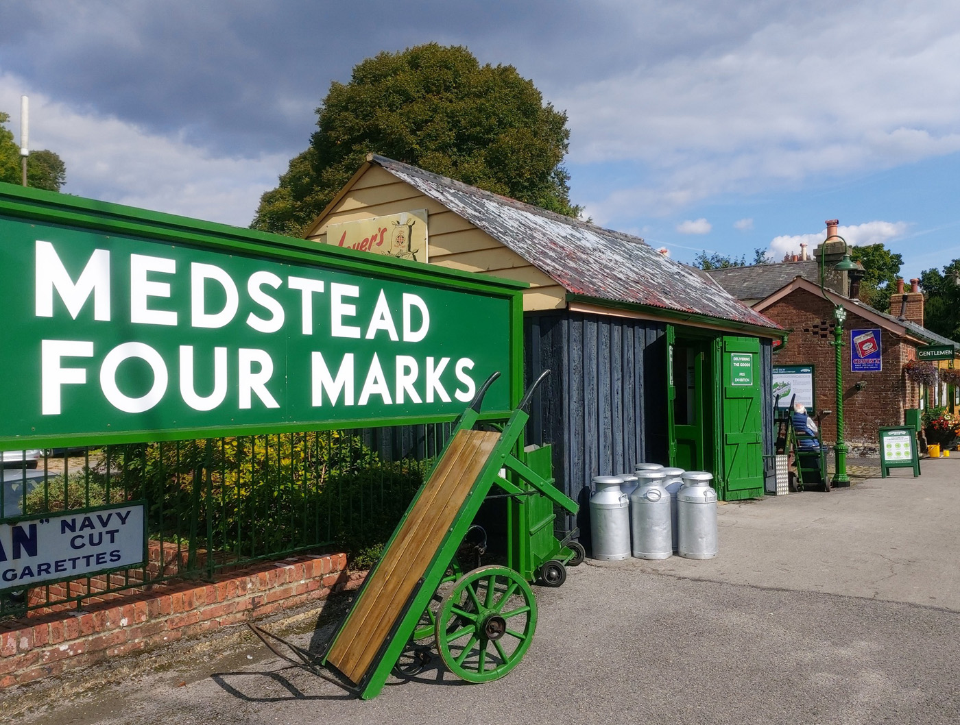
On a beautiful sunny early autumn morning, some 21 ramblers, including two guests, gathered at the Watercress Line car park for start of our linear walk. First to get to our start point – which turned out slightly more problematic than it should have. We walk the short distance down Station Road to West Street ready to catch 11.05 Winchester to Alton bus. However, expected bus is late, then later.… and by 11.25 or so has still not appeared. We converse with a regular local bus-user who has consulted her “App”. Because of a driver shortage the bus should arrive at 11.37. Eventually it appears a few minutes after that. Fortunately, it’s a double-decker or some of our number may have been standing for the short journey to Four Marks. Alighting at the Hazel Road stop, we walk the short distance to the station, crossing over the bridge, and are ready at last to begin our ramble proper.
Leaving Four Marks station we head north-west along a track, turning left onto Five Ash Road for about 10minutes before taking footpath right in a north-west direction skirting Medstead village.
Walking westward we’re eventually rewarded with splendid views south towards to the South Downs, identifying unmistakable Cheesefoot Head on the ridge before us. Next, we turn south-west past Hattingley Valley Vineyard. We walk through some of the vineyards and can’t resist a taste of the tempting ripening white grapes which are sweet and delicious. Hattingley Valley is one of many vineyards that continue to be established all over the south, and now even further north in the country. Climate change and increased knowledge of where grapes will thrive have encouraged landowners to invest considerable sums of money in a product that often takes up to 7/8 years to come to fruition and begin a return. We are almost spoilt for choice in our region with many vineyards to visit and sample their wines.
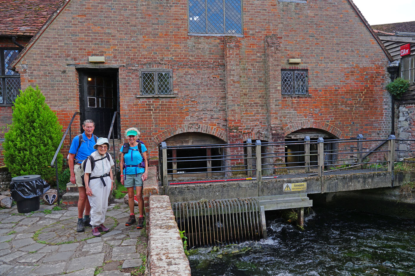
We cross Chalky Hill Lane and continue on to the Oxdrove Way, a bridleway that takes us southwest to Old Alresford where the end of our walk brings us back alongside the famous watercress beds and beautiful riverside paths. We pass the old Fulling Mill, now a pretty private house. The building dates from the 13th century and was saved from dereliction in about 1951. The fulling of cloth was a method used to tighten and shrink cloth into a closely woven product. In early times the pressing and kneading was done by human feet, in shallow streams, using fullers earth. In due course water power took over and the mills became known as Fulling Mills.
Old Fulling Mill
Our walk has taken us on varied paths and bridle ways, through stands of woodland, copse and across typically wide expanses of undulating Hampshire agricultural countryside. Now looking a little greener and less parched, after some recent rain. We
spotted numerous red kites circling determinedly over a tractor busy harrowing a field, a buzzard, hare and most odd looking fungus structure growing in the earth beside the Oxdrove bridle way.
Alresford is a delightful and attractive town. First founded in the 13th century and making its fortune in the wool trade, more recent industry saw the commencement of water cress production in the 1860’s. Much of the pleasing old buildings in the main streets are a result of rebuilding in the 18th century after two great fires. It’s now home to many thriving independent shops, boutiques and café’s along with various hostelries. Because of our tardy return to the town, we had little chance to browse around its attractions – a trip for another day.
A fascinating history of the Watercress Line can be found on their website.
Author: Val Wood, Programme Organiser
Photography: Sandy Arpino and Rose Field
Posted inUncategorized|Comments Off on 21 September 2022
Walking the southern half of Offa’s Dyke Trail along the English-Welsh border
Having walked a number of undulating National Trails in recent years – including the South Downs Way and Hadrian’s Wall Path – I looked for something a little more challenging and remote to tackle in 2022. The obvious choice seemed to be the Offa’s Dyke Trail – though the walking was a bit tougher at times than I’d anticipated.
The trail is 177 miles long, linking Sedbury Cliffs – near Chepstow – on the banks of the Severn estuary with the coastal town of Prestatyn on the shores of the Irish sea. It is named after, and often follows, the spectacular dyke that King Offa ordered to be constructed in the 8th century, probably to divide his Kingdom of Mercia from rival kingdoms in what is now Wales
My plan was to complete the southern half in 2022, walking from Sedbury to Knighton, leaving the remainder for 2023. I planned the walk back in January, to ensure accommodation as close to the trail as possible; experience has taught me that trekking miles off a defined trail for an overnight stop is very demoralising. And as I only ever carry a day-pack, I relied on Walklite to move my luggage daily between hotels and B&Bs (which they did perfectly).
Chepstow Castle
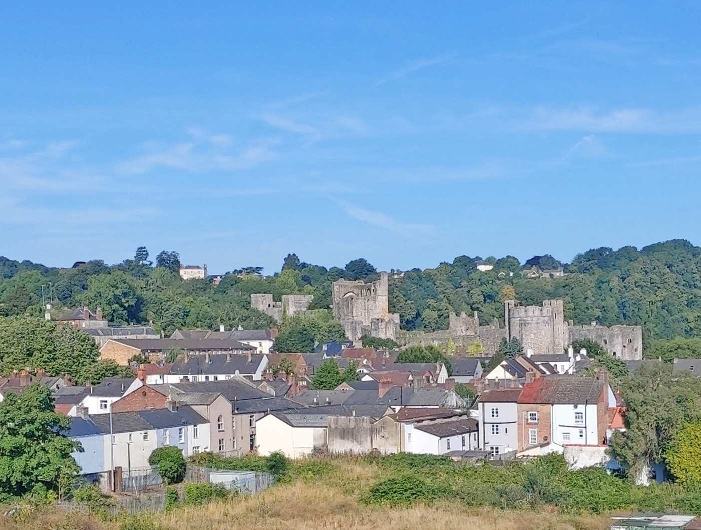
So I set off in mid-August – unfortunately in a heat wave – to start my adventure. After four trains and a reprimand for carrying an out-of-date railcard, I finally arrived at Chepstow to encounter two recurring themes of my walk: hills and castles. My hotel was a long climb up from the station in sweltering temperatures, hauling my luggage. Undaunted, after checking in I bounced back down the hill to explore Chepstow and its impressive cliff-top castle.
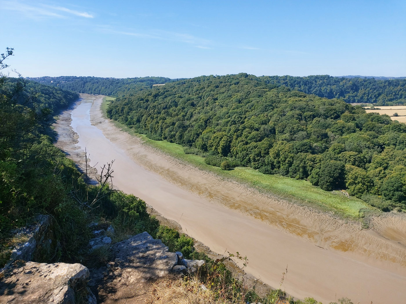
The next morning there was a 3 mile hike to the start of the trail at Sedbury cliffs, overlooking the River Severn and its suspension bridge. From here the walk proper began. After clearing the residential area, the trail followed the course of the River Wye northwards, though high above the river on steep, wooded slopes – thankfully providing shade from the increasing heat of the day.
Sadly, though this stretch of the River Wye is billed as superb scenery, the water levels were so low that only vast stretches of unsightly mud were visible. Months of low rainfall and above-average temperatures had taken their toll.
River Wye low water level
By late afternoon I crossed the River Wye – which looked a good deal healthier at this point – on a footbridge, providing access to the striking ruins of Tintern Abbey.
Bizarrely, next morning I found the footbridge closed for 9 months! This necessitated following paths along the river bank until a crossing could be made 2 miles further north and the trail regained. The river remained my focus for the rest of the day, taking me to Monmouth.
Once again, much of the trail passed through woodland high above the river – and along shady sunken lanes, thick with moss and ferns – offering relief from the burning sun that maintained temperatures of 31 degrees even at 6pm.
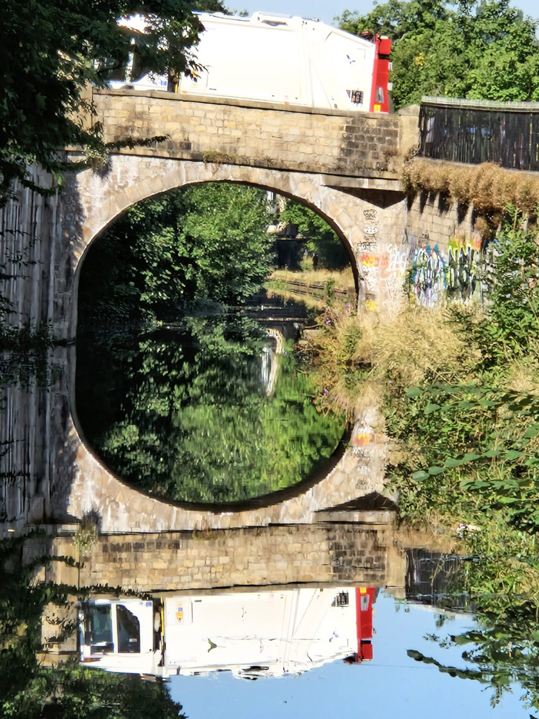
Not that the day’s walking was easy. Three times the trail dipped down to the river and climbed back up again. By the time I found my lodgings in Monmouth I’d done a surprising 14.7 miles and climbed a total of 2,875ft in elevation. Fortunately, at the last of these dips – down into Redbrook – there was access to the Boat Inn, via an interesting disused railway bridge across the Wye, where I could refill empty water bottles.
The next 2 days were easier by comparison, though the sun was unrelenting, there was no shade and nowhere to access even water. Leaving Monmouth and the river behind, the trail crossed endless fields, some with crops others for sheep. Rather surprisingly I passed an area of apple orchards growing fruit for cider.
After a delightful overnight at Tre-Adam it was on to Pandy and the Lancaster Arms Guest House, that couldn’t have been more cordial.
From Pandy the trail heads to Hay-on-Wye, through the Brecon Beacons National Park: a 17 mile stretch across moorland. The path climbs quite steeply onto Hatterrall Ridge and a first trig point at 1,522ft. From here the route follows along the top of Hatterrall Ridge for over 9 miles, gently climbing to 2,220ft before descending to Hay-on-Wye. So this section of the trail is not only very demanding but completely exposed, with no opportunity to break out.
Given the heat of the previous days and the Met Office weather warning of extreme heat for the following days, I made the disappointing decision that it would be unsafe to walk Hatterrall Ridge as planned. I would have to return at a later date, once the heat wave had passed.
Instead, I decided to set out from Pandy early to climb to the first trig point – just to trial this steep climb – then retrace my steps. This 6 mile round-trip could be completed safely before midday, providing a taster without over-exposing myself. On such a clear day the views were amazing – and the pathway leading north was extremely inviting.
Arriving in Hay-on-Wye by taxi later, the uncomfortable 32/33 degree heat confirmed my assessment that Hatterrall Ridge was for another day. Even my hotel room was unbearable, requiring a search for shade in the town.
The next day had been planned as a rest day but – having rested much of the previous day – I headed back to Hatterrall Ridge, this time from its northern end. Again I started early, climbed for four miles then turned back before temperatures rose too high. As expected, the skies were blue and the views clear, improving with height.
The weather finally broke the following day: temperatures dropped 10 degrees and – being Wales – light rain settled in. It was good to be able to resume my planned walking. Two arduous days lay ahead – both over 14 miles distance with over 2,000ft to climb – but it was pleasing to be clocking up miles on the trail again.
The highlight of the first of these days was traversing Hergest Ridge, made famous by Mike Oldfield: miles of peaty moorland sitting above the surrounding hills, roamed by sheep and wild Welsh ponies.
The next day at last reunited with Offa’s Dyke after an absence of over 50 miles. The dyke appears as an earthwork hump – with deep trenches on either side where it is best preserved. For much of the day the route was clearly defined by the direction of the dyke – no signposts required.
Which brought me to Knighton and the end of my initial plans. However, a week later I was back in Pandy, ready to tackle the abandoned trek along Hatterrall Ridge. The weather was kind – just a couple of light showers. The walk was stellar. The sense of remoteness, standing on top of the world, was awesome. Though, truth be told, I’ve sworn to never undertake such a demanding day ever again!
Let’s see if that holds true when I take on the northern half of Offa’s Dyke trail in 2023.
A walk visiting three cities with the aid of five buses
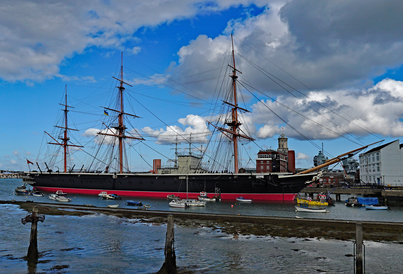
At 0800hrs on a sunny Saturday we boarded the Stagecoach 37 bus from Petersfield and alighted at Drift Road Clanfield where we made our first change of bus. The Firstbus 8 then took us onto Portsea Island, Portsmouth being the only city in the UK to be on an Island. Reaching the transport interchange at The Hard we had a short break to stretch our legs and to look across to HMS Warrior, the first iron clad warship for the British navy built in 1860.
HMS Warrior
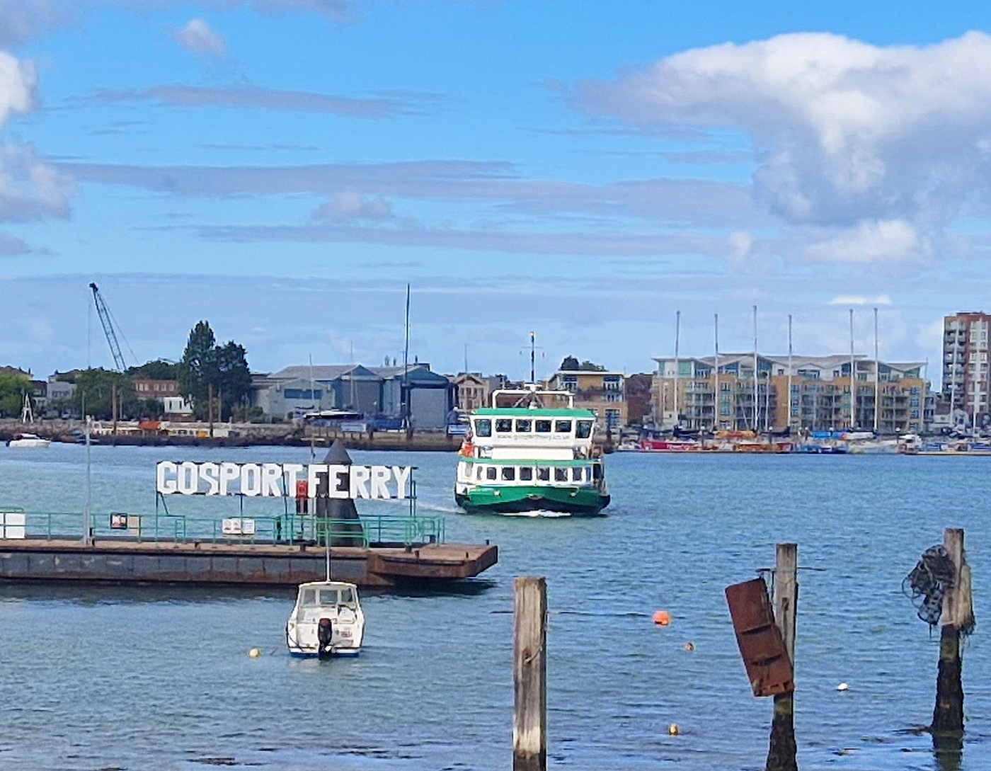
Beyond could be seen the entrance to Portsmouth Historic Dockyard and we watched as the passenger ferry plied its way across the harbour from Gosport.
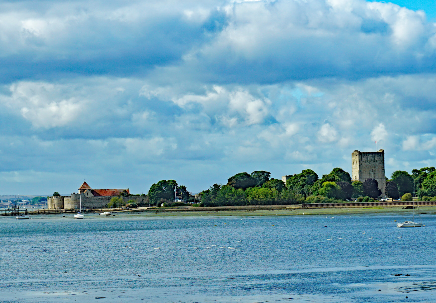
It was one of the days with no trains running owing to a strike which meant there were extra passengers for our next bus, the Solent Ranger X4 to Southampton. It was a double decker instead of the usual single decker so we went upstairs, and as we left Portsmouth behind and joined the M275 we had a good view of Portsdown Hill where the three forts were built to give early warning of any French invasion. Then, across the water on our left, appeared Portchester Castle built by the Romans in the 3rd Century. After 1066 it was converted into a Norman castle, then between 1665 and 1815 served as a prisoner of war camp.
Portchester Castle From the Bus
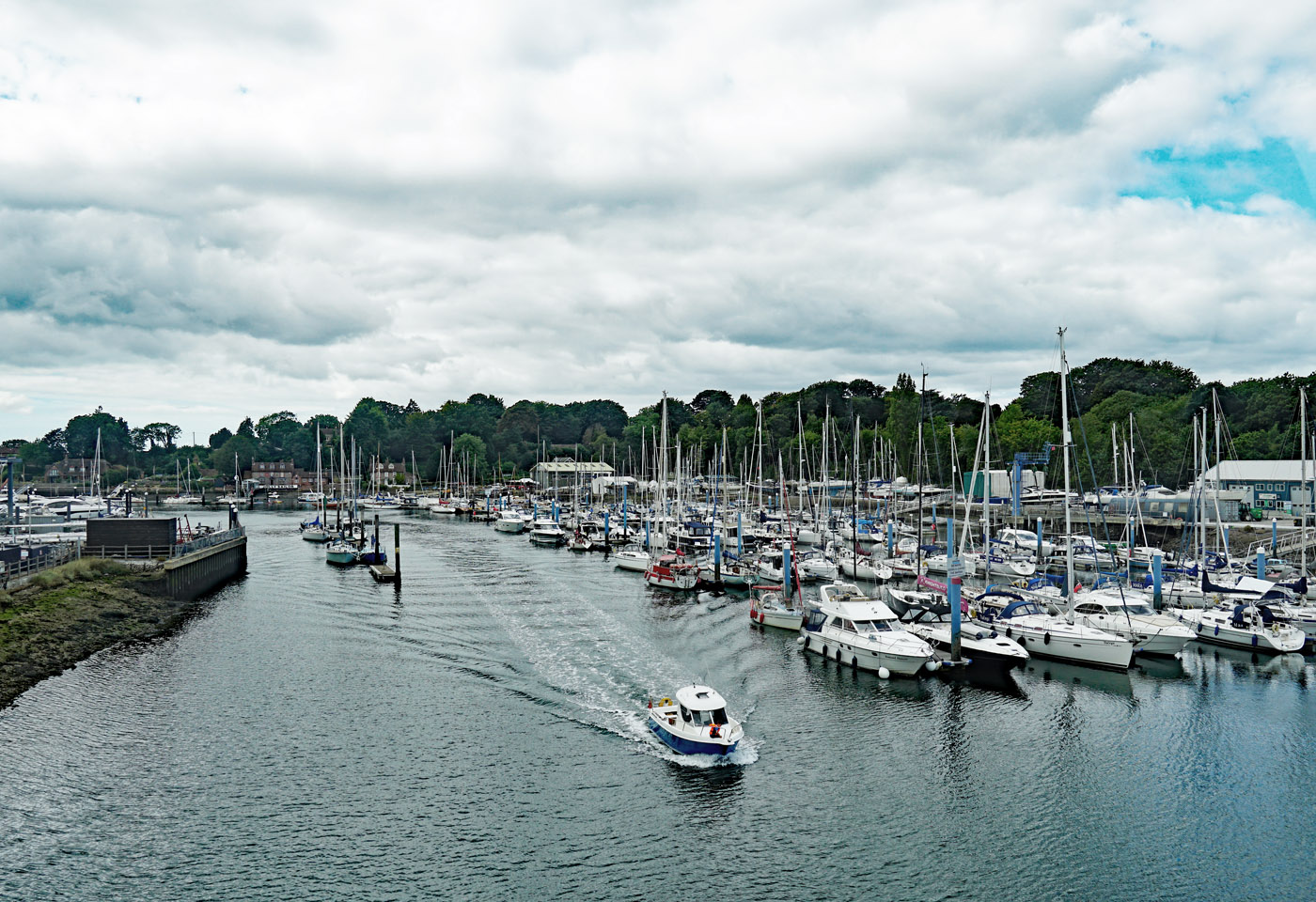
As we passed over the river Hamble boats of all sizes could be seen, a very busy place. After meandering through various small communities, including threading its way through the narrow streets of Tichfield, our bus reached the bridge over the river Itchen and entered Southampton.
River Hamble from the Bus
Leaving the X4 close to Town Quay and the Isle of Wight ferry terminal, we started our walking tour of Southampton’s old town area and stopped at God’s House Tower, the oldest part dating from 1189. The tower was built in 1400 to house gun powder and cannons to protect Southampton from attack by the French via The Solent. We took a brief look inside to see the stone construction with ancient timbers in the vaulted ceiling. It has been tastefully renovated and now open as a museum.
Outside God’s House Tower
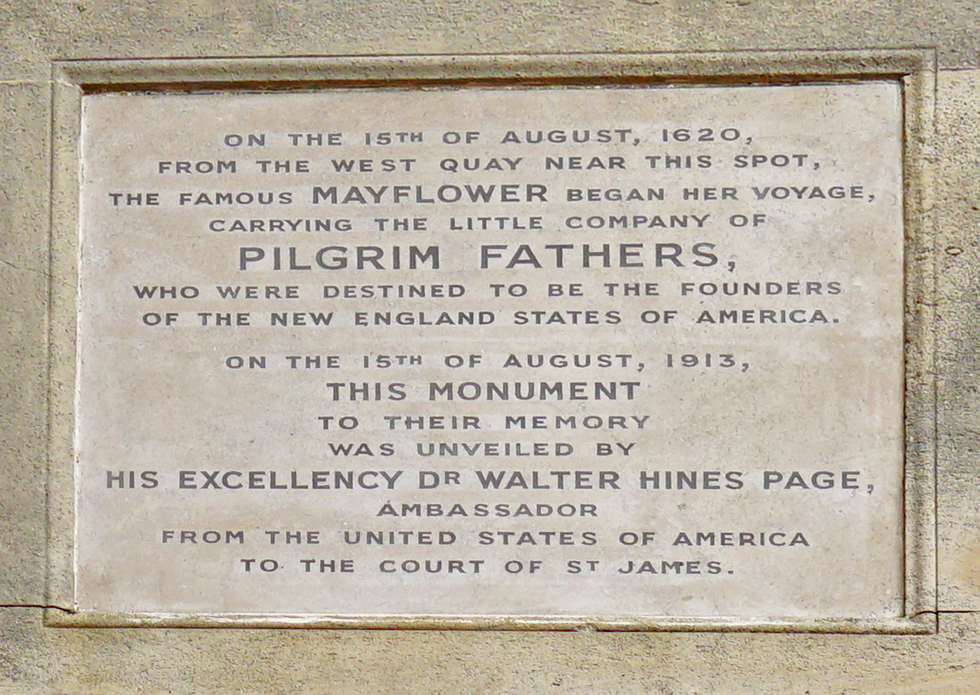
We then paused opposite Mayflower Park to read the inscription on the Mayflower Memorial. In 1620 the Mayflower embarked from here and sailed to Plymouth before leaving England for America.
Mayflower Memorial
Memorial Plaque
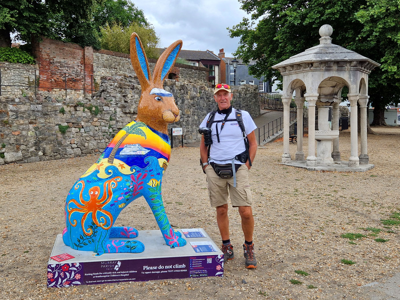
We passed some of the Hares of Hampshire, a public art event, currently in both Southampton and Winchester.
Some of the Hares of Hampshire
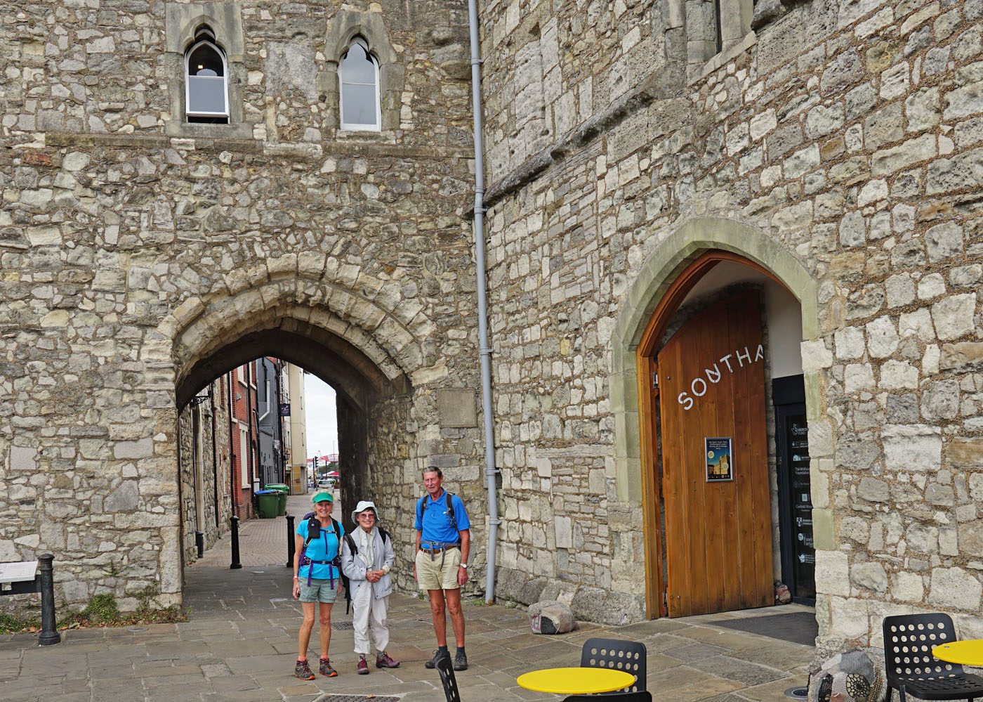
We continued onward in the old harbour area where we stopped at Westgate with substantial walls built following the French raid of 1338. Through this archway marched some of the army of Henry V on their way to Agincourt in 1415. Strange to think that water would have been lapping the walls at that time, the waterfront now in the distance, beyond Mayflower Park.
Cruise Ship Close by
Passing through the city wall we followed a steep cobbled lane to reach Bugle Street and the Tudor House, now a museum. Its first owner (in 1348) was John Wytegod, a wealthy merchant who also owned property nearby, including King John’s Palace. This was a two storey building with living quarters on the first floor, while the ground floor was used for storing casks of wine unloaded from ships moored at the quayside in front of the house. Readers may like to note the museum is well worth an extended visit one day to explore the building and see all the ancient artefacts displayed.
The Tudor House Museum
Continuing along Bugle Street we joined the walls walk, looking down onto what used to be the harbour and across to the very modern West Quay Shopping Centre. Continuing on, we reached the Bargate, a grade 1 listed Medieval gatehouse constructed in Norman times as the main gateway to the city. Before boarding the bus to Winchester we ate our packed lunch in a nearby tranquil park, away from the multitude of shoppers.
Bargate
From Southampton the Blue Star 1 took us via Chandlers Ford and we enjoyed panoramic views of the Hampshire countryside from the top deck. On reaching our third city, Winchester (Venta Belgarum in Roman times), we alighted in North Walls for a walk through Winnal Moors Nature Reserve, owned and managed by the Hampshire & Isle of Wight Wildlife Trust. We followed the meandering pathway alongside the river Itchen and on through the water meadows, at times on a wooden walkway.
River Itchen, Winchester
Leaving the Reserve we followed the Itchen to the City Mill, a National Trust property where grain is milled and the flour sold in the Trust shop. We explored the mill which straddles the river and also watched a video showing otters that visit the mill during the night. So much history and so much to see in this beautiful city lying at the Western end of The South Downs National Park.
Winchester City Mill
Leaving the mill, we crossed the road and walked through the public garden opposite King Alfred’s statue. Even though we were in a drought situation, the flower beds still looked remarkably attractive. With seven minutes to spare we reached the bus station for the Stagecoach 67 home to Petersfield. A day packed full of history, with visits to places some of the group had never before seen, or even known about.
Author: Gordon Churchill
Photos: Paul & Linda Farley
Posted inUncategorized|Comments Off on 22 August 2022
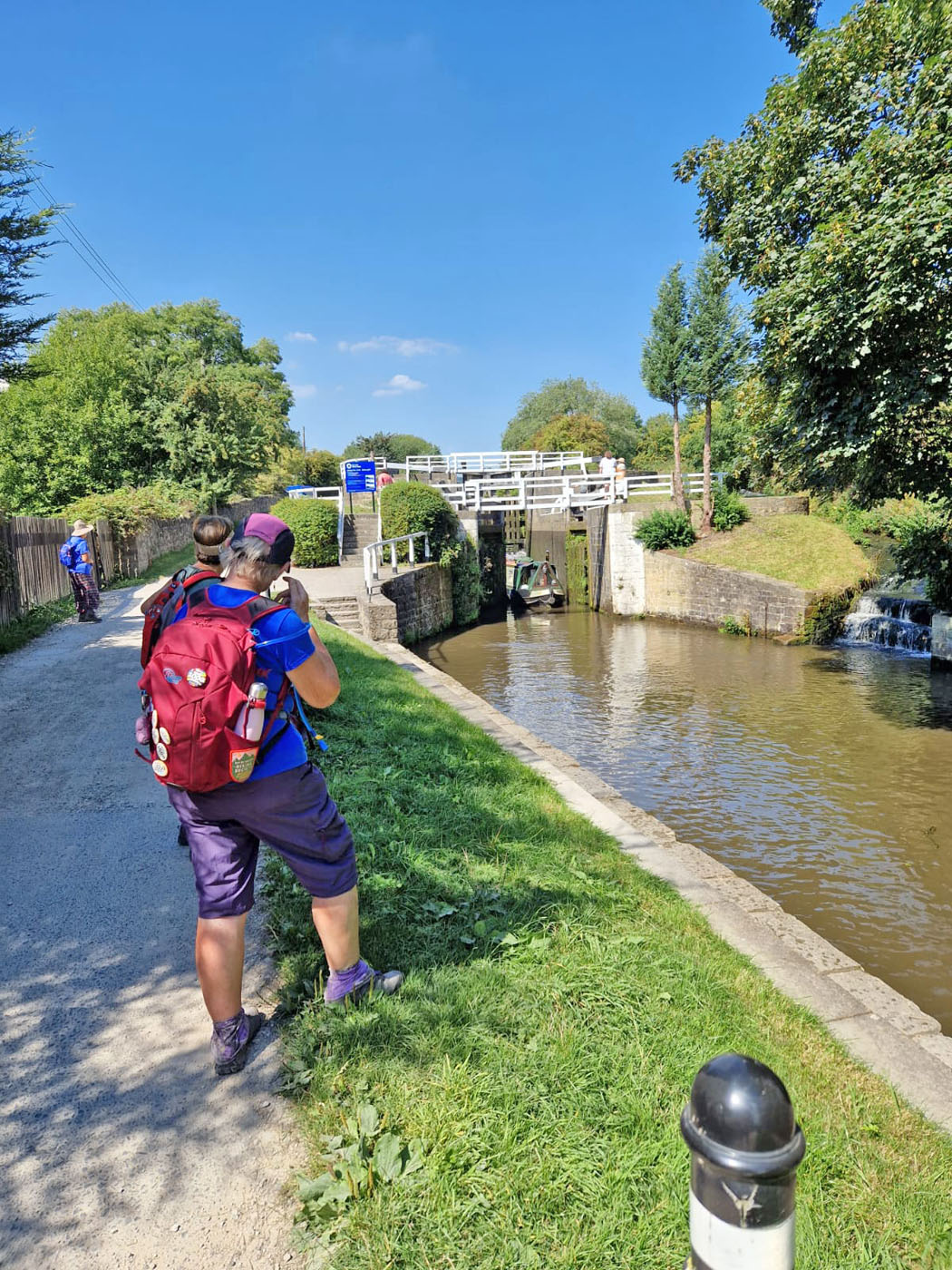
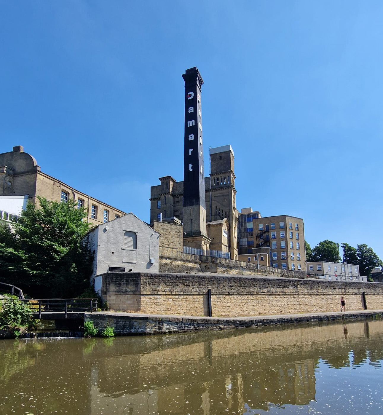
In view of the extreme weather we experienced and the fact each day was hotter than the last we decided to walk from the east of Leeds back to the centre. Apart from the heat this was an easy train ride to start the journey and we knew we could be back before the hottest part of the day.
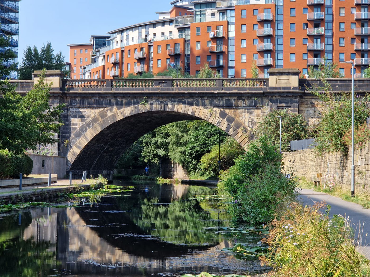
Leaving the railway station we made our way down to the Aire and Colder navigation, following the Trans Pennine Way along the tow path. We came across an automated lock, it had traffic lights to prevent narrow boats from entering unless they had permission, then motors attached to the large gates to open them, no muscle power needed. Shade was at a premium so we utilised every inch of it we could find. Making sure we stopped to drink every 15 minutes we passed under the M1 still walking between the river and the canal on a narrow stretch of land.
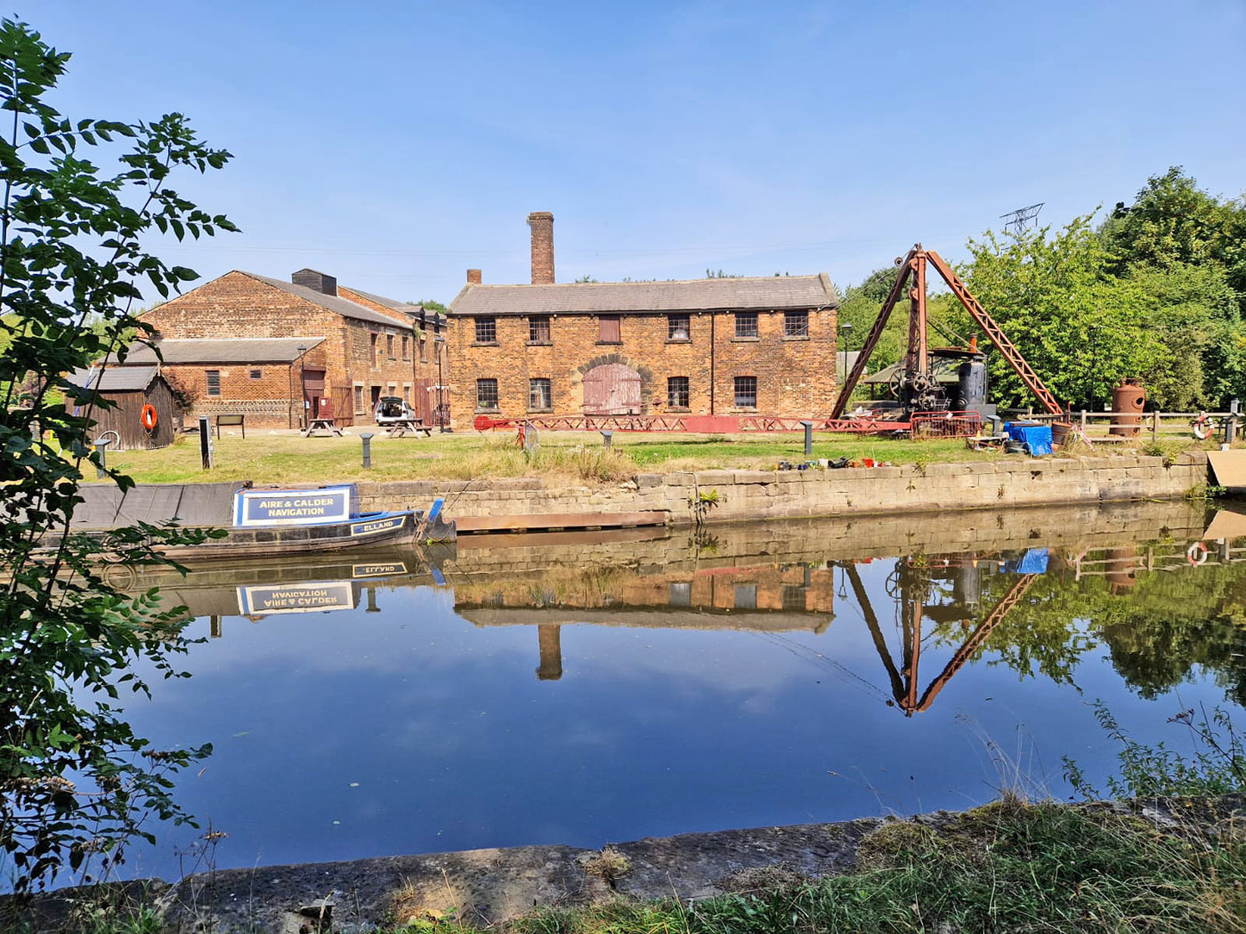
Suddenly we were forced off the tow path onto a very spongy, wobbly pathway that felt like it was going to tip you into the water at any minute. Having managed to remain upright we followed the diversion along the southern side of the waterways. We were keen to stop at Thwaite Mills- on an island in the river so had to walk past it and then back track due to the diversion. The place was heaving, not just with visitors but also due to the fact there was a bus and coach meeting, with vintage vehicles everywhere. We made our way to the cafe grateful for a cold drink and ice cream. The thought was to look around the mills but listening to the fact that part of the buildings was closed, that it was hot in the mills, that the visit would take 2 hours we decided against it.
Thwaite Mills
Therefore, we continued to follow the Trans Pennine Way as we walked into the outskirts of Leeds with the thermometer rising by the minute. It was fascinating to follow a path, not well signposted or easy to find as we wended our way through new housing built alongside the water. Suddenly a pond appeared, complete with fountain, surrounded by houses. It certainly kept our interest.
A Delightful Pond
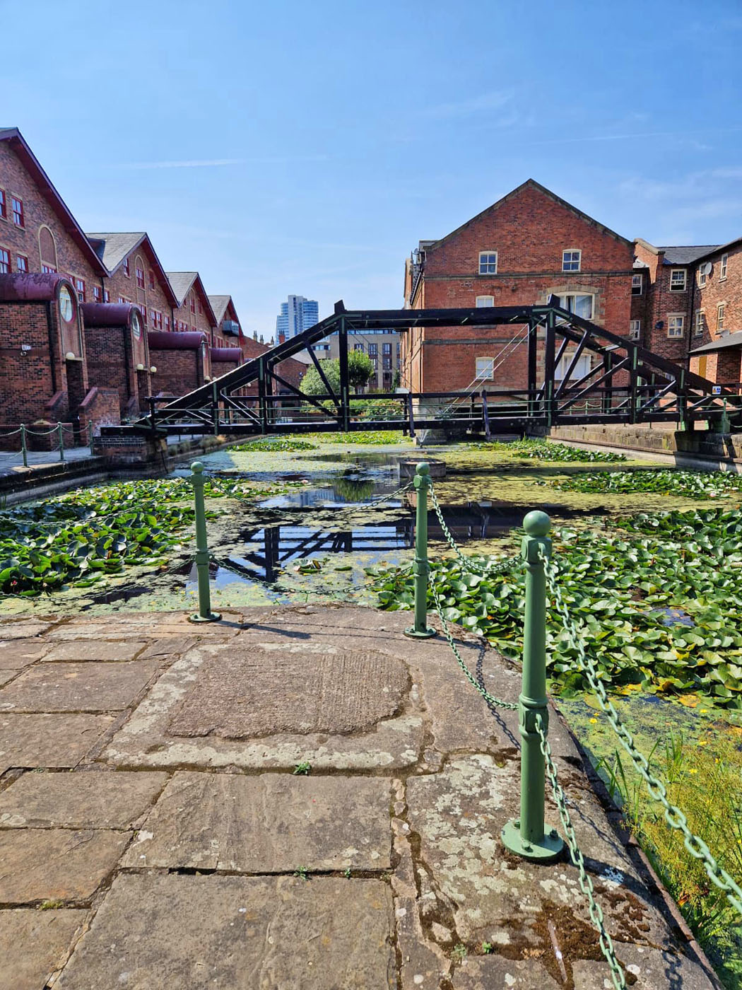
We ended up back at the Armouries Museum that we had visited the previous day on our ramble around Leeds City Centre. With difficulty we found a way alongside the water as we made our way through the city centre savouring the variety of buildings, so very old and some still being constructed.
The Final Bridge (On this Section)
Eventually we were on the last leg along the canal. We stopped to watch a narrow boat negotiating the lock and chatted to the helmsman. He was rather disgruntled as he had had a phone call that day to say they were closing the canal at 5 o’clock. He therefore had a few hours to navigate through Leeds centre and get onto the river system otherwise he would be stranded on the canal until it reopens- and that could we weeks.
Waving him a cheerful farewell we left the canal back to our hotel. Four days of walking, one day of sightseeing, 70+ miles of walking in temperatures rising to 31 degrees, we felt we had had a great time, lots of fun and learnt many things about the Leeds area. Now we are planning the next part towards Liverpool.
Author and Photographer: Lynne Burge
Posted inUncategorized|Comments Off on Leeds to Liverpool Canal – Day 4
In view of the extreme heat we decided to stay on the train for another stop. Rather than back tracking to Keighley we alighted at Silsden in order to shut down the mileage. We only missed a few fields by doing this and nothing of significant interest.
After climbing over a delightful stone stile and the walking across the fields we reached the canal at one of the many swing bridges. These are used to take roads across the canal or for farmers to access their land. Thankfully there was enough shade along the towpath to stop us overheating.
Stone Stile
The significant change today was the terrain. Yes, we were still walking along the towpath but to either side rose hills and moorland. I got quite excited! There was no desire to be walking up the hills today as it was so hot but in a couple of months time the ramblers will be up the road at Malham and we will be walking those hills.
Hills!
After walking for an hour, we came across a delightful pop-up cafe by the side of the canal complete with picnic tables and shade. It would have been churlish not to stop. So a while later after sampling their beverages we continued on our way. More herons were spotted but by this time we were becoming blasé about them.
Then we came across a charming village, built around the contours of the canal and bursting with charm. The inevitable swing bridge gave access across the canal to the village which consisted on 4 layered houses, older mill style terraces, converted buildings and a small but well formed playground for children. It gave the air of being a community that would be a pleasure to live in.
The Village
More Village
The canal followed the main road for most of the rest of the way into Skipton but it was high above the road so afforded us good views around and the road was not too noticeable. By now the heat was becoming intense and we were happy to arrive in Skipton. After a small wander we alighted upon a restaurant that we entered for a refreshing cup of tea. Air conditioning! We sank into the seats and enjoyed the respite we found there.
Skipton is an interesting town, evidently seen better days but was well worth a browse around before we took the train back to Leeds.
Author and Photographer: Lynne Burge
Posted inUncategorized|Comments Off on Leeds to Liverpool Canal – Day 3
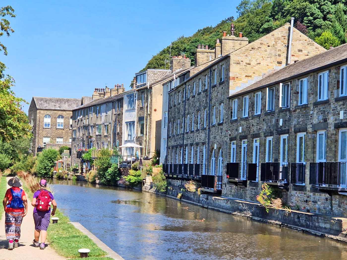
We retraced our steps and took the train back to Shipley where we finished yesterday. Finding our way back towards the canal we crossed over and continued until we reached the River Aire with the purpose of following a sculpture trail that we had read about. This proved to be a little less high brow than we had anticipated. Frogs, cats, dogs, fish all abounded in different formats! Then we reached the mills of Saltaire which bordered both sides of the canal.
Sculpture Trail Example
Saltaire is a Victorian village built by Sir Titus Salt to house the workers for his textile mill. Houses were provided for the workers, wash houses, schools, a hospital, a park and several churches. This philanthropic mill owner wished to see the offspring of his workers better themselves and to give them a decent standard of living.
Saltaire Mill
We wandered around the converted mill taking in the history of the place, marvelling at his foresight to look after his workers well so they in turn worked hard to make the mill prosperous.
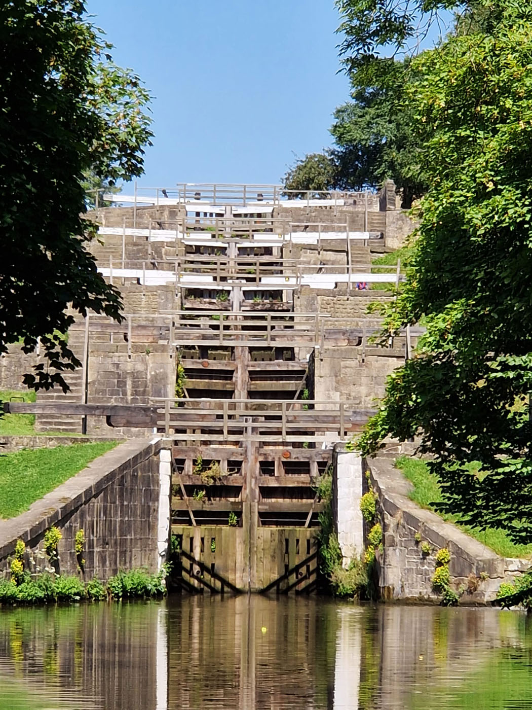
After a sojourn there we walked on along the towpath eventually arriving at Bingley 5, a huge rise of locks that take the canal up a height of around 20 metres. Unfortunately, no boat was being taken through them, so we were unable to see how the incredible bank of staircase locks worked in practice. After eating our lunch and sampling a delicious ice cream from the local cafe we wandered on.
Bingley 5
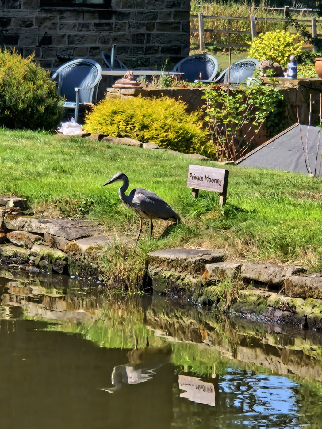
The sun was pounding down by this time and we sought shelter at every opportunity. At one stage I thought I had spotted a plastic heron in someone’s garden only to realise it was the real thing!
My “Plastic” Heron!
Eventually we came to our turn off to walk to the nearest railway station. This was along a hot, dusty road, not our favourite part of the day. As we ambled through Keighley we glimpsed the houses that all mill workers used to live I – 2 up, 2 down terraced properties that had no front garden and no back garden. Just rows of terraces facing each other. Not much space to call your own.
Industrial Buildings
Then we arrived at the train station and enjoyed a fast journey back for a refreshing shower out of the heat. Altogether we walked almost 14 miles in the heat.
Author and Photographer: Lynne Burge
Posted inUncategorized|Comments Off on Leeds to Liverpool Canal – Day 2
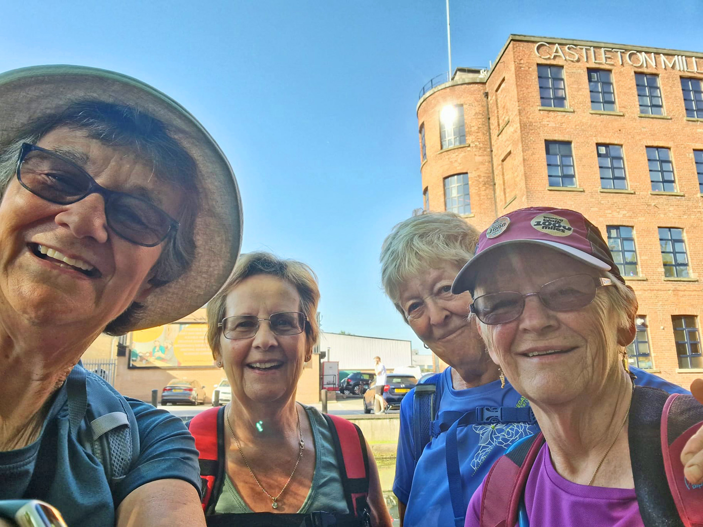
The idea was formed to walk along the Leeds to Liverpool canal, in two separate sessions to sample the industrial historical landscape. Four of us travelled by train up to Leeds and booked into an hotel.
This morning saw the four of us – Lesley, Anne, Dulcia and myself setting off along the canal. What we hadn’t bargained on was the sweltering temperature. We set off along the canal admiring the wonderful reflections of the old buildings in the water and the peacefulness of the area. The beauty was all around us in the history of the area, in the buildings and the quietness of the canal itself.
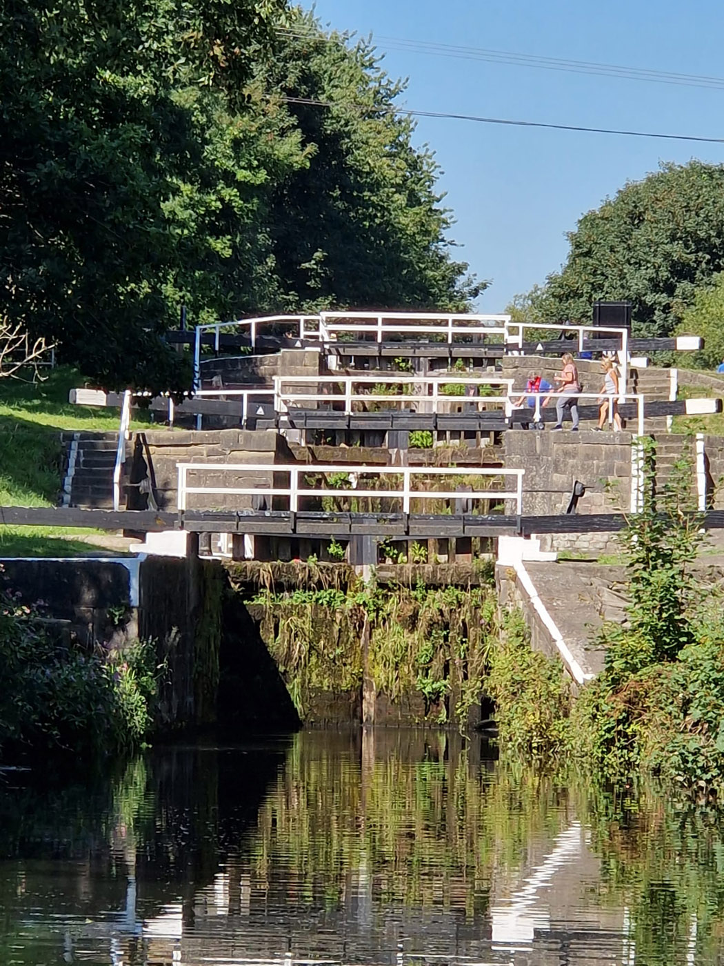
The route took us along the tow path which also doubles as a National Cycle path, so you can imagine the scenario – 4 ramblers of a certain age being bombarded by a veritable mass of cyclists as they made their way along the track! This eased out the further along the way, but there was a steady thrum of wheels coming towards us or creeping up from behind. Staircase locks abounded along the canal. The most consisted of three interlocking locks, generally two, and showed the height difference that the canal makers had to deal with.
Lock Staircase
Unusually not many narrow boats were making their way along the waterway, maybe due to the fact that some canals are having to close due to lack of water and they would worry that they might not be able to get back. This gave us a quieter feel to the day but deprived us of the usual lively banter with the boat owners.
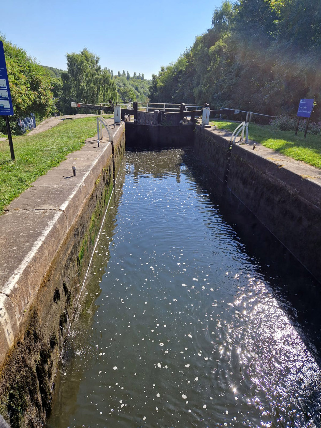
Underfoot it alternated between tarmac and gravel, very little was the usual hard packed earth that I would associate with a towpath. We walked on past locks, houses, fields, nature reserves. At one stage the remains of Kirkstall Abbey rose above its surroundings to delight us. Aside from the locks we encountered several swing bridges. These required the relevant key to unlock them to allow a narrow boat to open them, go past, shut the bridge and then continue on their way, an irritating obstruction on their journey.
Lock
Eventually we reached the much anticipated Apperley Bridge! This has been recommended to us by a member of staff at the hotel, it evidently had a good cafe, so we had to sample it. She was right, it was a good cafe. We sat in the shade, gratefully sipping cooling drinks and eating our lunch, having a much needed break and respite from the relentless sun. By this time we had walked around 10 miles, plenty of exercise on such an extremely hot day but…….we made the decision to alter our end goal as it made catching the train back to Leeds easier.
Industrial Building
We continued in along the tow path grateful for the trees that overhung the path and walked almost another 5 miles to Shipley where we could catch the train. Trying to use a ticket machine that seemed to have overheated in the extreme sun did not make the job of purchasing train tickets very simple. Eventually, after much persistence tickets were obtained and we gratefully took the train journey back to our start passing many of the places that we had walked that day.
Reflections in the Canal
It was a delight to return to our hotel, have a refreshing cup of tea and a shower, ready for more discoveries tomorrow.
Author and Photographer: Lynne Burge
Posted inUncategorized|Comments Off on Leeds to Liverpool Canal-Day 1
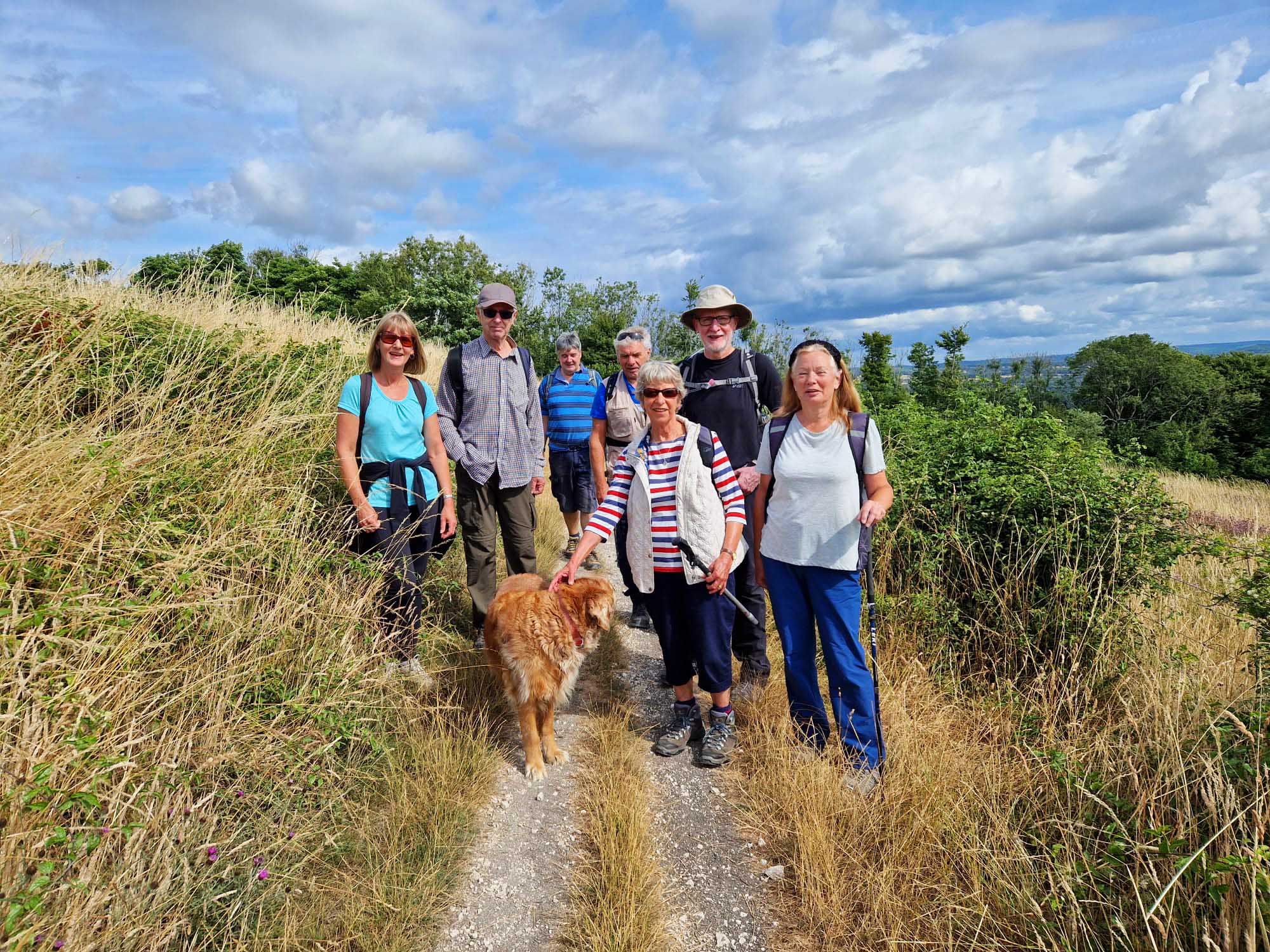
8 of us, plus a dog began the walk from Elsted Village Hall on a coolish, breezy morning. Having negotiated the narrow village roads as two enormous combines rattled through, we took the quieter road that leads down to Treyford. We soon left the road behind us and took an ancient track along past a couple of fields. Then we began the climb up the aptly named Mount Sinai. This is one of those very steep hills that just as you think you are reaching the top then shows you another sharp incline. By the time the path levelled out the idea that the day was a little chilly was long forgotten and layers were taken off.
The View From Elsted
The fields that we passed were all very parched, in fact for the whole of the walk the ground was rock hard. We descended slightly to meet the South Downs Way, not long after it had passed Buriton Farm, climbing steadily up through trees to where we left the SD path for a while.
As the trail led us downwards, we passed a sign marking the site of Old Monkton Village. Apart from a few bumps in the field nothing else visible is left, the majority of the site being covered by undergrowth and trees. On researching the origins of this village little is known, or even why it was abandoned. After a short stop to refresh ourselves, we continued along the track passing Yew Tree Cottage and meeting a quiet backwater of a road. Passing Staple Ash Farm, we began yet another ascent, walking through large areas covered by the West Dean Estate. They have started to use the local wood to weave their fences and are making habitats for butterflies and other wildlife. We would have read up about it all on an information board but it was old and obscured by damp patches over the time it had been there.
Old Monkton
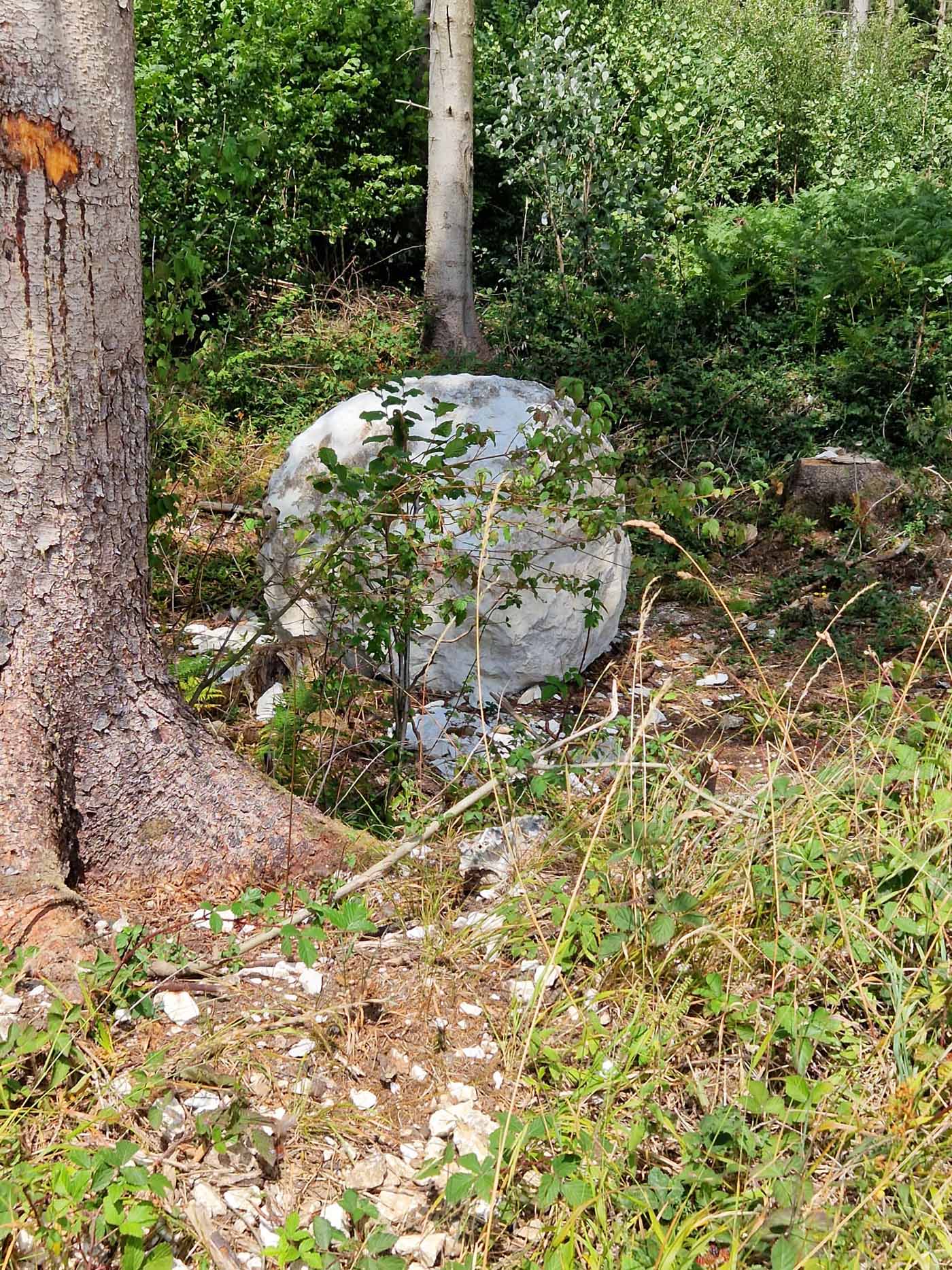
It was in this area that we came across at least 3 large spheres of chalk of which we were bemused to see. How did they get there? Why there and what were they meant to represent? We had no answers but remembered one of the ramblers, on a previous walk, talking about them being part of a sculpture. On researching at home later in the day I discovered that they were placed there by Andy Goldsworthy and in fact there are a dozen of them scattered in the area. Time for a ‘hunt the chalk sphere’ game?
One of Andy Goldsworth’s Stones
And Another!
It was in this area that we came across at least 3 large spheres of chalk of which we were bemused to see. How did they get there? Why there and what were they meant to represent? We had no answers but remembered one of the ramblers, on a previous walk, talking about them being part of a sculpture. On researching at home later in the day I discovered that they were placed there by Andy Goldsworthy and in fact there are a dozen of them scattered in the area. Time for a ‘hunt the chalk sphere’ game?
Musing over the balls of chalk we reached the South Downs Way again and turned along it, enjoying the views across the countryside.
Sheep Avoiding Us!
After our lunch stop, we descended a steep path that led us to Didling Church, or the church of the shepherd as it is sometimes called. The small building nestles in to the side of the Downs and is well worth a visit. It has no electricity, candles provide light when needed, with ancient pew ends and probably one of the oldest fonts in the country. The bell dates from 1587. A quaint diversion on our walk
Didling Church
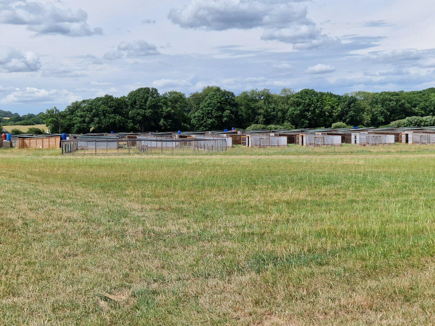
Passing easily through the small hamlet of Didling we made our way across the fields back towards Elsted. Having walked across a field full of crops but with huge cracks in the parched earth we came across a large area full of huts and wired runs. This is an area where half a million pheasants are raised each year to supply various shoots. In some of the pens small birds could be seen scuttling around.
The Pheasant Pens
One last haul across the final fields led us to the back of the local pub. Resisting the temptation to sit with a cooling drink we made our way back to the village hall and a welcome change of footwear before wending our way home.
One Saturday in early July, 15 members of Petersfield Ramblers set off from Emsworth Recreation Ground to explore the most south-westerly corner of West Sussex, walking east through the inland villages before dropping down to the coast to enjoy the sea views. A theme for the ramble was to observe the changes over the past 40 years, since one member had spent a glorious childhood in the area.
The weather was perfect for hiking – sunny but not over hot – and careful planning had ensured that the tide would be in, providing the best views across the bays.
Leaving the busy sports ground – where numerous football matches and exercise classes were underway – our group followed the road down towards Emsworth, before turning off into Brook Meadow nature reserve, a wet meadow consisting of 5 acres of grassland, surrounded by woodlands and flanked by two streams.
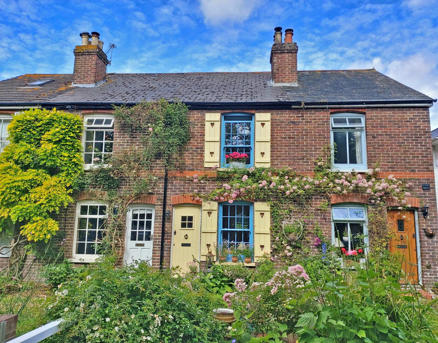
We then turned north, following Lumley Mill Lane for a mile into Westbourne. Initially the lane ran alongside a small, crystal-clear stream in which we were enchanted to see small fish. Equally delightful were the quaint cottages lining our route.
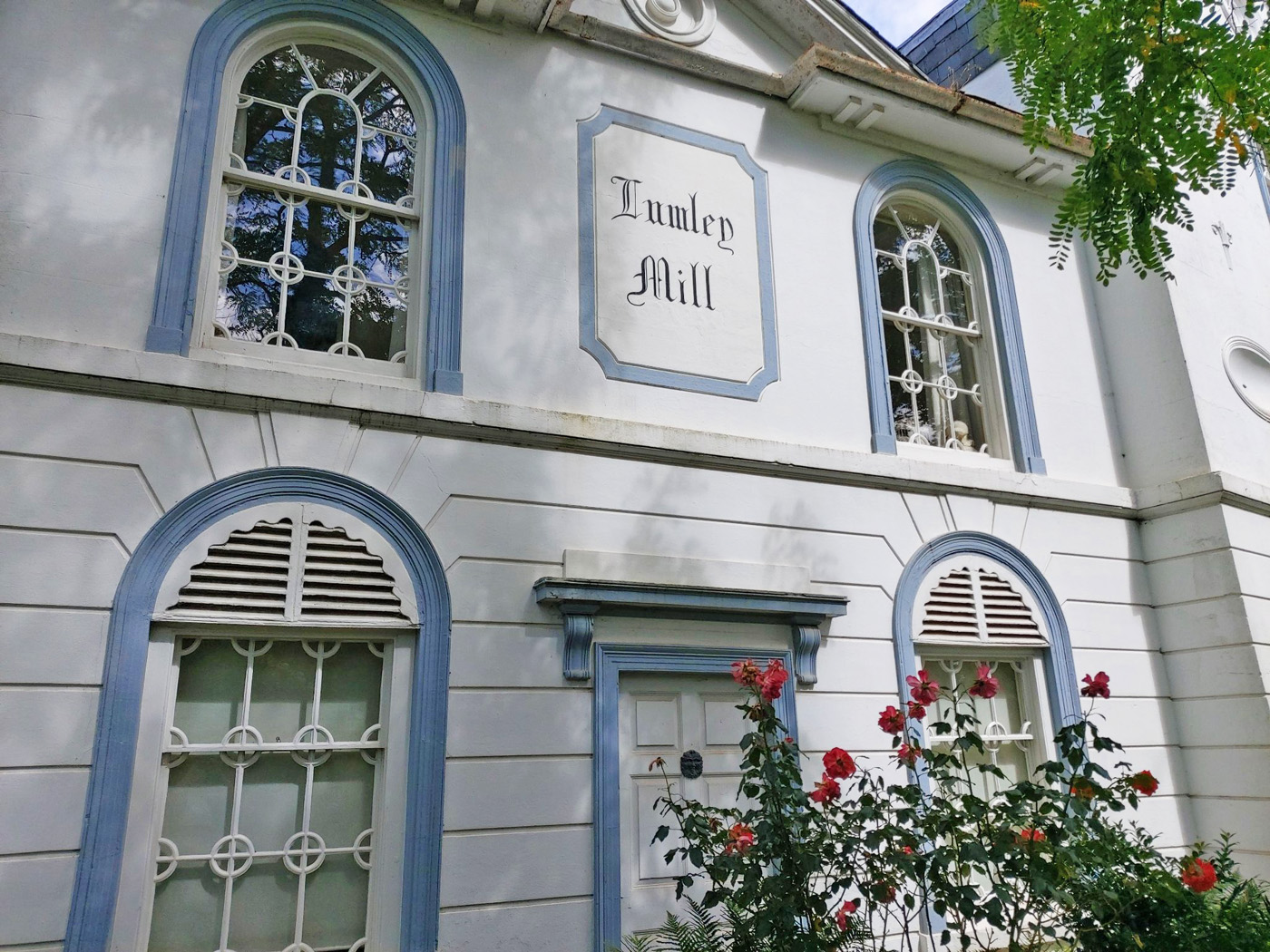
Further along we found the impressive white building titled Lumley Mill, a large pseudo-Gothic house built in the mill complex in the early 1800s. The original working mill was built by Lord Lumley in 1760, powered by a canal specially dug for the purpose from the river Ems (and still flowing today) and an iron overshot waterwheel. Burnt down in 1915, the foundations of the working mill could be seen just past the white house.
Further along Mill Lane it was necessary to take a wide bridleway bridge over the busy – and noisy – A27. Built in the late 1980s, this was identified as a very significant change from the days of our member’s childhood.
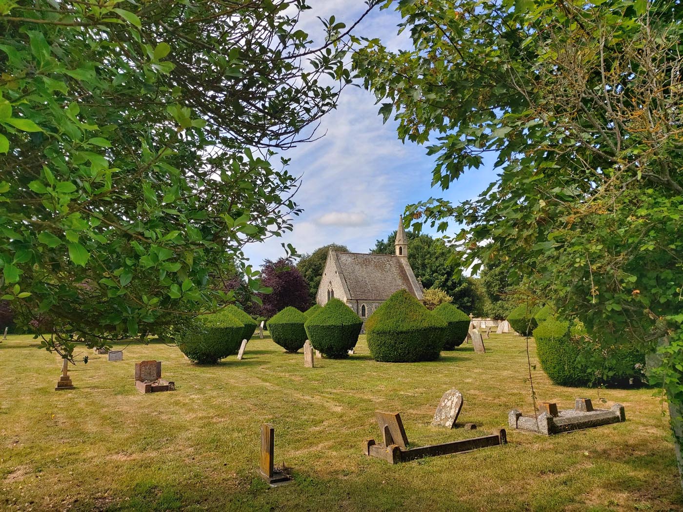
On reaching Westbourne we took an easterly direction through the village – picturesque with its many thatched cottages – before turning down Cemetery Lane. The extension graveyard and chapel here are distinctive for their tidiness, incorporating some splendid yew topiary.
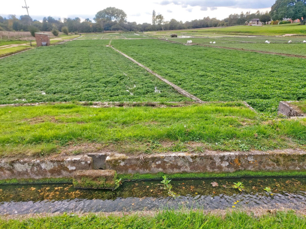
Our route took us through sprawling Woodmancote village, across wheat fields and through woodland before requiring us to re-cross the A27 via a small bridleway bridge. We then entered Hambrook, after stopping to observe some rather derelict watercress beds.
Far more uplifting was the extensive wild flower meadow that led into a new housing estate in Nutbourne. Continuing in a southerly direction, crossing first the railway and then the A259, we finally left habitation behind. On paths lined with majestic teasel plants, we hastened down to the shore and the beckoning sea.
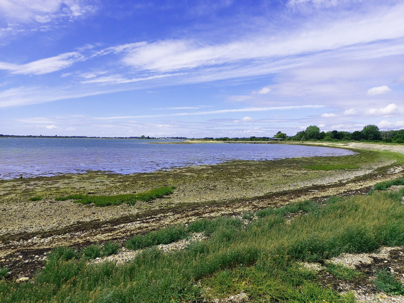
As always, the sea did not disappoint. With sunny blue skies and an incoming tide, the Nutbourne / Prinsted coast looked its best. In truth, with the tide out the outlook can be one of endless smelly, grey mud – but, having planned our walk using tide charts and weather forecasts, we were able to appreciate a fine seascape (give or take a line of seaweed at the water’s edge!).
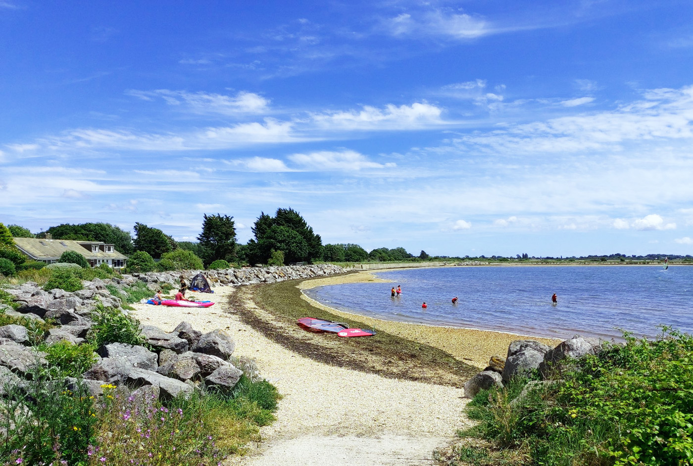
In fact, the sea appeared so appealing that a handful of bathers had taken to the water.
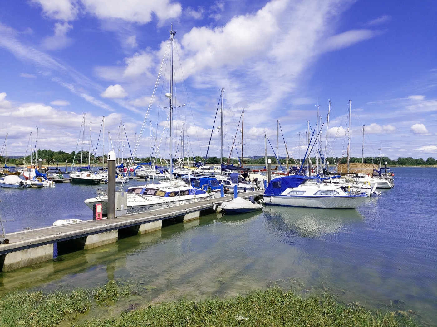
Continuing round the sea wall, before turning inland, we passed through Thornham Marina with its assembly of white and blue yachts stretching out from floating pontoons; rigging blown onto masts providing a pleasant background tinkling.
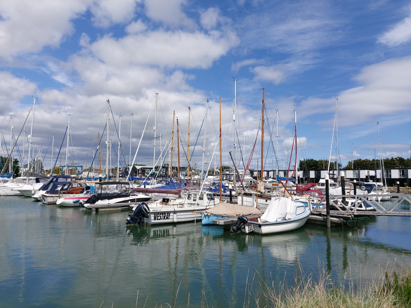
Traversing the headland of Thorney island, we again briefly encountered the sea, looking across to Emsworth, before passing through Emsworth Yatch Harbour with its ‘houses on stilts’. Our local member could recall the transition of her childhood haunt into an embryonic marina in the mid-1960s.
After pausing to avail ourselves of the coffee, cake and facilities offered at The Deck, we retraced our steps up Lumley Mill Lane and beyond to the Recreation Ground, where morning football had been replaced by afternoon cricket.